Approximate Location Map
Large Map »
Latitude: 51.1816 / 51°10'53"N
Longitude: -3.4469 / 3°26'48"W
OS Eastings: 298963
OS Northings: 143481
OS Grid: SS989434
Mapcode National: GBR LK.5YBM
Mapcode Global: VH6GM.6KMJ
Plus Code: 9C3R5HJ3+J6
Entry Name: Hartlip House
Listing Date: 6 November 1975
Grade: II
Source: Historic England
Source ID: 1057594
English Heritage Legacy ID: 264743
ID on this website: 101057594
Location: Dunster, Somerset, TA24
County: Somerset
District: Somerset West and Taunton
Civil Parish: Dunster
Built-Up Area: Dunster
Traditional County: Somerset
Lieutenancy Area (Ceremonial County): Somerset
Tagged with: House
1.
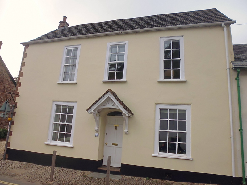
5366 DUNSTER WEST STREET
(West Side)
No 26 (Hartlip House)
SS 9843-9943 4/110 6.11.75
II GV
2.
Early 19th century frontage. Stucco, ashlar quoins, rubble gable, modern concrete
tiles, eaves, end gables. Two storeys. Three windows, sashes with glazing bars,
flush frames. Central recessed panelled door in elliptical head opening with arched
fanlight, later tiled hood on brackets.
Listing NGR: SS9896643482
External links are from the relevant listing authority and, where applicable, Wikidata. Wikidata IDs may be related buildings as well as this specific building. If you want to add or update a link, you will need to do so by editing the Wikidata entry.


Other nearby listed buildings
