Approximate Location Map
Large Map »
Latitude: 51.1814 / 51°10'52"N
Longitude: -3.4471 / 3°26'49"W
OS Eastings: 298947
OS Northings: 143454
OS Grid: SS989434
Mapcode National: GBR LK.5Y9F
Mapcode Global: VH6GM.6KHQ
Plus Code: 9C3R5HJ3+G4
Entry Name: Ardith
Listing Date: 22 May 1969
Grade: II
Source: Historic England
Source ID: 1057595
English Heritage Legacy ID: 264745
ID on this website: 101057595
Location: Dunster, Somerset, TA24
County: Somerset
District: Somerset West and Taunton
Civil Parish: Dunster
Built-Up Area: Dunster
Traditional County: Somerset
Lieutenancy Area (Ceremonial County): Somerset
Tagged with: Building
1.
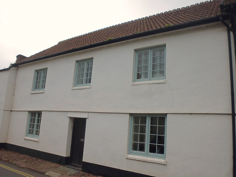
5366 DUNSTER WEST STREET
(West Side)
No 30 (Ardith)
SS 9843-9943 4/112 22.5.69
II GV
2.
18th century with later alterations. Render, Bridgwater pattern tiles. Two storeys.
Three windows, modern wood casements with glazing bars. Later central recessed door.
Listing NGR: SS9895043457
External links are from the relevant listing authority and, where applicable, Wikidata. Wikidata IDs may be related buildings as well as this specific building. If you want to add or update a link, you will need to do so by editing the Wikidata entry.


Other nearby listed buildings
