Approximate Location Map
Large Map »
Latitude: 51.1812 / 51°10'52"N
Longitude: -3.4474 / 3°26'50"W
OS Eastings: 298931
OS Northings: 143435
OS Grid: SS989434
Mapcode National: GBR LK.5Y6X
Mapcode Global: VH6GM.6KCV
Plus Code: 9C3R5HJ3+F3
Entry Name: Thyme Cottage
Listing Date: 22 May 1969
Last Amended: 4 August 1983
Grade: II
Source: Historic England
Source ID: 1173593
English Heritage Legacy ID: 264746
ID on this website: 101173593
Location: Dunster, Somerset, TA24
County: Somerset
District: Somerset West and Taunton
Civil Parish: Dunster
Built-Up Area: Dunster
Traditional County: Somerset
Lieutenancy Area (Ceremonial County): Somerset
Tagged with: Cottage Thatched cottage
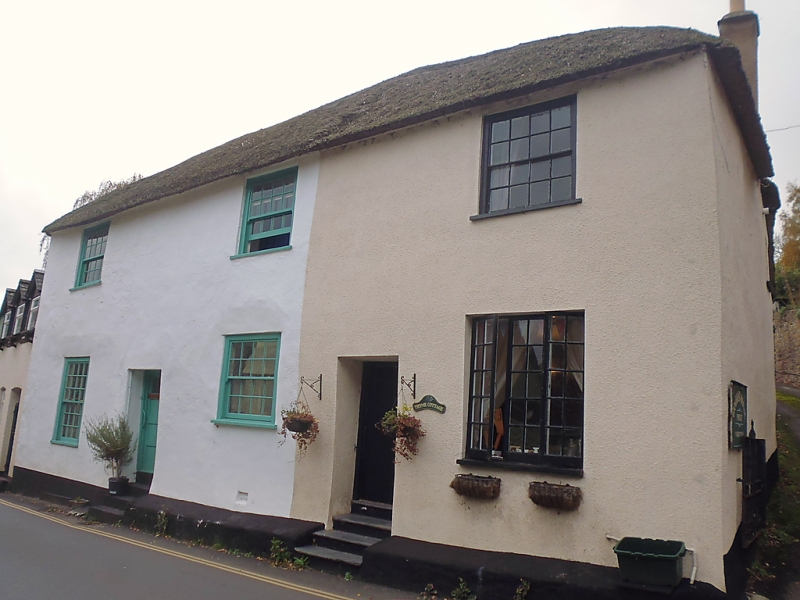
1.
5366 DUNSTER WEST STREW
(West Side)
Nos 34a (Thyme Cottage) and 34b
(formerly listed as No 34)
SS 9843-9943 4/113 22.5.69
II GV
2.
Early 19th century frontages. Colourwashed rendering, hipped thatch roof. Two
storeys. Three windows, sashes with glazing bars, exposed frames, 2 doors in square-
head recesses.
Listing NGR: SS9893043431
External links are from the relevant listing authority and, where applicable, Wikidata. Wikidata IDs may be related buildings as well as this specific building. If you want to add or update a link, you will need to do so by editing the Wikidata entry.


Other nearby listed buildings
