Approximate Location Map
Large Map »
Latitude: 51.191 / 51°11'27"N
Longitude: -3.44 / 3°26'24"W
OS Eastings: 299463
OS Northings: 144514
OS Grid: SS994445
Mapcode National: GBR LL.56B3
Mapcode Global: VH6GM.BB7B
Plus Code: 9C3R5HR5+9X
Entry Name: Old Marsh Bridge
Listing Date: 7 October 1981
Grade: II
Source: Historic England
Source ID: 1057598
English Heritage Legacy ID: 264752
ID on this website: 101057598
Location: Dunster, Somerset, TA24
County: Somerset
District: Somerset West and Taunton
Civil Parish: Dunster
Traditional County: Somerset
Lieutenancy Area (Ceremonial County): Somerset
Tagged with: Bridge
The following buildings should be added to the list:-
SS9844 DUNSTER CP SEA LANE
3/120 Old Marsh Bridge
(formerly listed in Carhampton)
7.lO.81
-
II
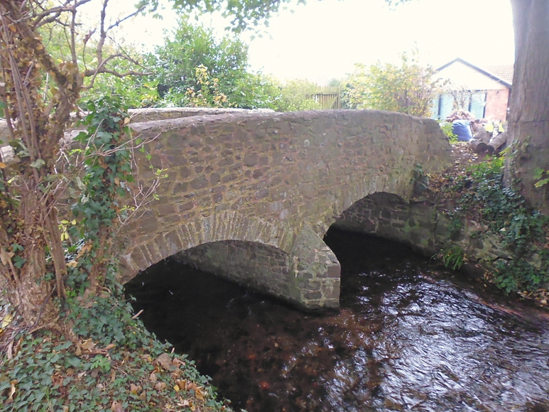
Footbridge. Dated 1772. Red sandstone random rubble. Two segmental arches with random
voussoirs, pointed cutwater between, hit and miss coping to parapet swept back at either
end, damaged on north-east side. Ham stone date stone on east front with name of the
builders: W and G Rawle, inscribed.
Listing NGR: SS9946344514
External links are from the relevant listing authority and, where applicable, Wikidata. Wikidata IDs may be related buildings as well as this specific building. If you want to add or update a link, you will need to do so by editing the Wikidata entry.


Other nearby listed buildings
