Approximate Location Map
Large Map »
Latitude: 51.101 / 51°6'3"N
Longitude: -3.4082 / 3°24'29"W
OS Eastings: 301496
OS Northings: 134469
OS Grid: ST014344
Mapcode National: GBR LM.BVTB
Mapcode Global: VH6H0.WL29
Plus Code: 9C3R4H2R+CP
Entry Name: Naked Boy's Stone, at Ngr St 0150 3447
Listing Date: 21 December 1984
Grade: II
Source: Historic England
Source ID: 1345621
English Heritage Legacy ID: 264822
ID on this website: 101345621
Location: Somerset, TA23
County: Somerset
District: Somerset West and Taunton
Town: Somerset West and Taunton
Civil Parish: Old Cleeve
Traditional County: Somerset
Lieutenancy Area (Ceremonial County): Somerset
Tagged with: Architectural structure
ST03SW OLD CLEEVE CP
BRENDON HILL
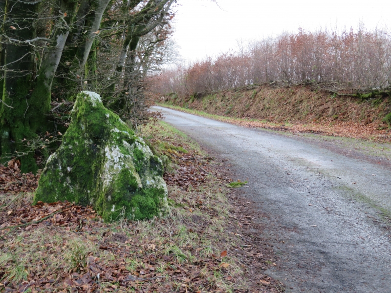
7/65 Naked Boy's Stone, at NGR ST01503447
-
- II
Boundary stone. Medieval. Undressd granite, roughly triangular in shape, about 1.25 metres high. Marks the boundary
between Old Cleeve and Brompton Regis parishes.
Listing NGR: ST0149634469
External links are from the relevant listing authority and, where applicable, Wikidata. Wikidata IDs may be related buildings as well as this specific building. If you want to add or update a link, you will need to do so by editing the Wikidata entry.


Other nearby listed buildings
