Approximate Location Map
Large Map »
Latitude: 51.147 / 51°8'49"N
Longitude: -2.719 / 2°43'8"W
OS Eastings: 349804
OS Northings: 138884
OS Grid: ST498388
Mapcode National: GBR MK.82YP
Mapcode Global: VH8B3.TFGK
Plus Code: 9C3V47WJ+RC
Entry Name: 18, Benedict Street
Listing Date: 15 March 1974
Grade: II
Source: Historic England
Source ID: 1057940
English Heritage Legacy ID: 265863
ID on this website: 101057940
Location: Glastonbury, Somerset, BA6
County: Somerset
District: Mendip
Civil Parish: Glastonbury
Built-Up Area: Glastonbury
Traditional County: Somerset
Lieutenancy Area (Ceremonial County): Somerset
Tagged with: Building
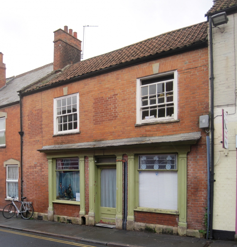
BENEDICT STREET
1.
1133
(North Side)
No 18
ST 4938 7/117
II
2.
C18. 2 storeys. Painted brick. Pantile roof, parapet to left with kneeler. Eaves.
2 windows. Keystones. Sashes in flush wooden frames, glazing bars. Early C19 shop-front
with overall cornice and fascia supported by 6 panelled pilasters. Small shop-window
to each side of doorway. 3/4-glazed door with rectangular fanlight.
Listing NGR: ST4980438884
External links are from the relevant listing authority and, where applicable, Wikidata. Wikidata IDs may be related buildings as well as this specific building. If you want to add or update a link, you will need to do so by editing the Wikidata entry.


Other nearby listed buildings
