Approximate Location Map
Large Map »
Latitude: 51.1483 / 51°8'53"N
Longitude: -2.7167 / 2°43'0"W
OS Eastings: 349962
OS Northings: 139028
OS Grid: ST499390
Mapcode National: GBR MK.7X4R
Mapcode Global: VH8B3.VDMK
Plus Code: 9C3V47XM+88
Entry Name: Easter Cottage
Listing Date: 15 March 1974
Grade: II
Source: Historic England
Source ID: 1167678
English Heritage Legacy ID: 265903
ID on this website: 101167678
Location: Glastonbury, Somerset, BA6
County: Somerset
District: Mendip
Civil Parish: Glastonbury
Built-Up Area: Glastonbury
Traditional County: Somerset
Lieutenancy Area (Ceremonial County): Somerset
Tagged with: Cottage
CHURCH LANE
1.
1133
(West Side)
No 3
(Easter Cottage)
ST 4939 5/31
II GV
2.
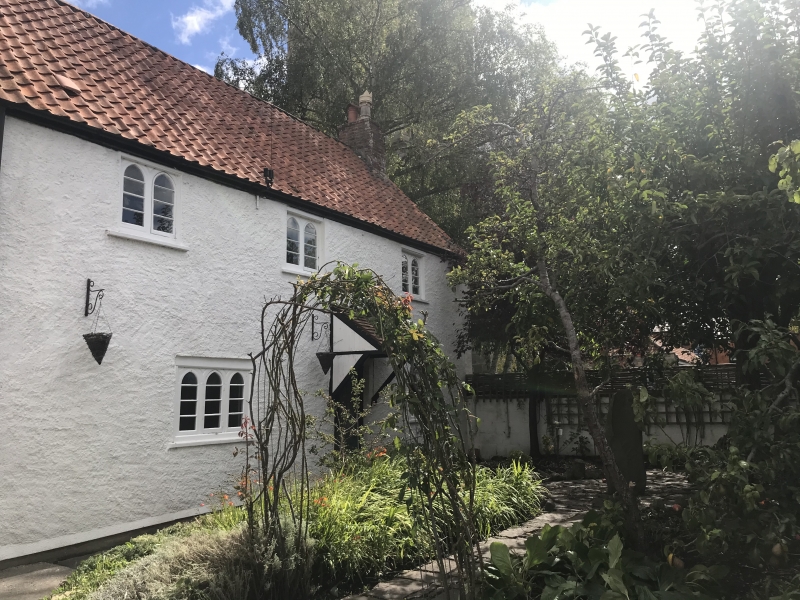
Possibly C17 structure, altered later. 2 storeys. Roughcast. Pantile roof.
Eaves. Detail of windows is early C19, 1st floor has 2-light and ground floor
has 3-light wood casements with Gothic heads. Central doorway with plain reveals
and tiled wooden hood over. Low extension to left.
No 3 and Hawkins House form a group.
Listing NGR: ST4996039031
External links are from the relevant listing authority and, where applicable, Wikidata. Wikidata IDs may be related buildings as well as this specific building. If you want to add or update a link, you will need to do so by editing the Wikidata entry.


Other nearby listed buildings
