Approximate Location Map
Large Map »
Latitude: 51.1483 / 51°8'53"N
Longitude: -2.7129 / 2°42'46"W
OS Eastings: 350227
OS Northings: 139020
OS Grid: ST502390
Mapcode National: GBR MK.7Y8N
Mapcode Global: VH8B3.XDML
Plus Code: 9C3V47XP+8R
Entry Name: 69, High Street
Listing Date: 15 March 1974
Grade: II
Source: Historic England
Source ID: 1167837
English Heritage Legacy ID: 265938
ID on this website: 101167837
Location: Glastonbury, Somerset, BA6
County: Somerset
District: Mendip
Civil Parish: Glastonbury
Built-Up Area: Glastonbury
Traditional County: Somerset
Lieutenancy Area (Ceremonial County): Somerset
Tagged with: Building
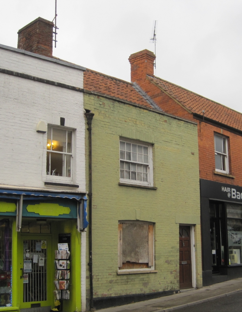
HIGH STREET
1.
1133
(North Side)
No 69
ST 5039 6/187
II GV
2.
Early C19 front to older cottage. Painted brick. Pantile roof. Large brick stack
between Nos 67 and 69. 1 window per storey, slightly cambered heads and keystones.
Sashes in plain reveals, glazing bars. Modern doorway to right.
Nos 51 to 69 (odd) form a group.
Listing NGR: ST5022839019
External links are from the relevant listing authority and, where applicable, Wikidata. Wikidata IDs may be related buildings as well as this specific building. If you want to add or update a link, you will need to do so by editing the Wikidata entry.


Other nearby listed buildings
