Approximate Location Map
Large Map »
Latitude: 51.1479 / 51°8'52"N
Longitude: -2.7142 / 2°42'51"W
OS Eastings: 350138
OS Northings: 138977
OS Grid: ST501389
Mapcode National: GBR MK.7XX4
Mapcode Global: VH8B3.WDZW
Plus Code: 9C3V47XP+48
Entry Name: 64, High Street
Listing Date: 15 March 1974
Grade: II
Source: Historic England
Source ID: 1057937
English Heritage Legacy ID: 265952
ID on this website: 101057937
Location: Glastonbury, Somerset, BA6
County: Somerset
District: Mendip
Civil Parish: Glastonbury
Built-Up Area: Glastonbury
Traditional County: Somerset
Lieutenancy Area (Ceremonial County): Somerset
Tagged with: Building
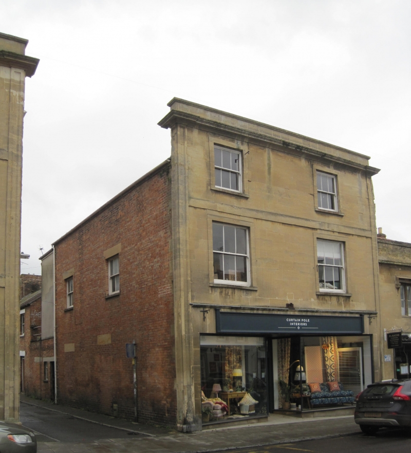
HIGH STREET
1.
1133
(South Side)
No 64
ST 5038 8/155
II GV
2.
Probably mid-Cl9. 3 storeys. Ashlar front. Heavily moulded cornice. Parapet.
Moulded pilasters flank fron. Stringcourse. 2 windows per storey, plain architrave
surrounds. Sashes in plain reveals, some glazing bars. Modern shop-front. One
of a pair with No 66.
Nos 60 to 66 (even) form a group.
Listing NGR: ST5013838977
External links are from the relevant listing authority and, where applicable, Wikidata. Wikidata IDs may be related buildings as well as this specific building. If you want to add or update a link, you will need to do so by editing the Wikidata entry.


Other nearby listed buildings
