Approximate Location Map
Large Map »
Latitude: 51.1479 / 51°8'52"N
Longitude: -2.7137 / 2°42'49"W
OS Eastings: 350172
OS Northings: 138984
OS Grid: ST501389
Mapcode National: GBR MK.7Y11
Mapcode Global: VH8B3.XD7V
Plus Code: 9C3V47XP+5G
Entry Name: 70-74, High Street
Listing Date: 15 March 1974
Grade: II
Source: Historic England
Source ID: 1057938
English Heritage Legacy ID: 265954
ID on this website: 101057938
Location: Glastonbury, Somerset, BA6
County: Somerset
District: Mendip
Civil Parish: Glastonbury
Built-Up Area: Glastonbury
Traditional County: Somerset
Lieutenancy Area (Ceremonial County): Somerset
Tagged with: Building
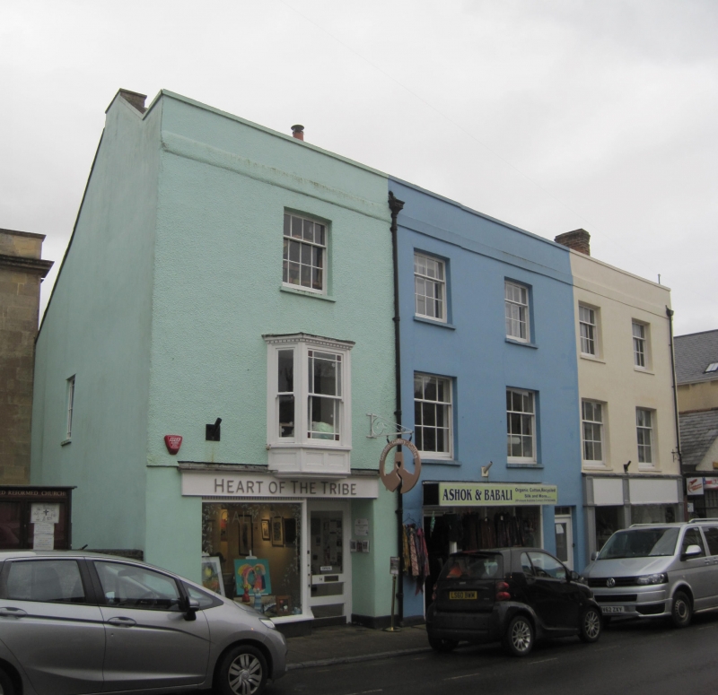
HIGH STREET
1.
1133
(South Side)
Nos 70 to 74 (even)
ST 5038 8/60
II GV
2.
Probably early C19, 3 storeys. Plain stucco fronts. Stringcourse at cornice
level. Parapet. 5 windows. Sashes in plain reveals, glazing bars. One wooden
bay of 3 lights to 1st floor of No 74. Dentilled cornice and close-set glazing
bars. Modern shop-fronts to all 3 properties.
Nos 70 to 74 (even) and congregational Church form a group.
Listing NGR: ST5017238984
External links are from the relevant listing authority and, where applicable, Wikidata. Wikidata IDs may be related buildings as well as this specific building. If you want to add or update a link, you will need to do so by editing the Wikidata entry.


Other nearby listed buildings
