Approximate Location Map
Large Map »
Latitude: 51.1449 / 51°8'41"N
Longitude: -2.7176 / 2°43'3"W
OS Eastings: 349901
OS Northings: 138652
OS Grid: ST499386
Mapcode National: GBR MK.83BP
Mapcode Global: VH8B3.VH64
Plus Code: 9C3V47VJ+XX
Entry Name: 40 and 42, Magdalene Street
Listing Date: 15 March 1974
Grade: II
Source: Historic England
Source ID: 1345451
English Heritage Legacy ID: 265987
ID on this website: 101345451
Location: Glastonbury, Somerset, BA6
County: Somerset
District: Mendip
Civil Parish: Glastonbury
Built-Up Area: Glastonbury
Traditional County: Somerset
Lieutenancy Area (Ceremonial County): Somerset
Tagged with: Building
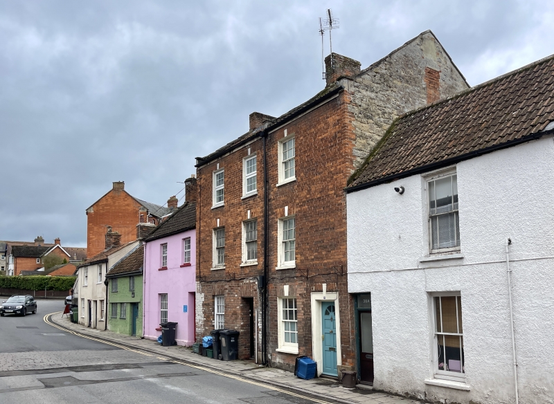
MAGDALENE STREET
1.
1133
(West Side)
Nos 40 and 42
ST 4938 7/168
II GV
2.
Early/mid C19. 3 storeys. Red brick. Eaves cornice. Pantile roof. 3 windows,
keystones. Sashes in plain reveals, glazing bars. Ground floor of No 42 has shop-window
to left and 1/2-glazed door with fanlight. No 40 has one sash and doorway to right.
1/2-glazed door flanked by painted panels.
Nos 40 to 50 (even) form a group.
Listing NGR: ST4989838654
External links are from the relevant listing authority and, where applicable, Wikidata. Wikidata IDs may be related buildings as well as this specific building. If you want to add or update a link, you will need to do so by editing the Wikidata entry.


Other nearby listed buildings
