Approximate Location Map
Large Map »
Latitude: 51.1476 / 51°8'51"N
Longitude: -2.7187 / 2°43'7"W
OS Eastings: 349825
OS Northings: 138948
OS Grid: ST498389
Mapcode National: GBR MK.7WKY
Mapcode Global: VH8B3.TFL3
Plus Code: 9C3V47XJ+2G
Entry Name: 5, Northload Street
Listing Date: 15 March 1974
Grade: II
Source: Historic England
Source ID: 1172992
English Heritage Legacy ID: 266002
ID on this website: 101172992
Location: Glastonbury, Somerset, BA6
County: Somerset
District: Mendip
Civil Parish: Glastonbury
Built-Up Area: Glastonbury
Traditional County: Somerset
Lieutenancy Area (Ceremonial County): Somerset
Tagged with: Building
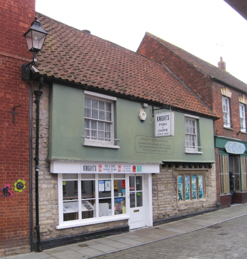
NORTHLOAD STREET
1.
1133
(West Side)
No 5
ST 4938 7/90
II GV
2.
Early C19 stucco to earlier fabric. 2 storeys, the upper slightly over-sailing.
Pantile roof. Eaves. 2 sashes with glazing bars on 1st floor. Ground floor has
C16/early C17 stone mullioned window of 4 lights with hoodmould. Modern shop-front
and doorcase to left.
Nos 5 to 9 (odd) and Marchant's Buildings form a group.
Listing NGR: ST4982538948
External links are from the relevant listing authority and, where applicable, Wikidata. Wikidata IDs may be related buildings as well as this specific building. If you want to add or update a link, you will need to do so by editing the Wikidata entry.


Other nearby listed buildings
