Approximate Location Map
Large Map »
Latitude: 51.2319 / 51°13'54"N
Longitude: -2.3202 / 2°19'12"W
OS Eastings: 377738
OS Northings: 148131
OS Grid: ST777481
Mapcode National: GBR 0S9.N77
Mapcode Global: VH97D.Q9RF
Plus Code: 9C3V6MJH+QW
Entry Name: Bridge
Listing Date: 31 January 1974
Grade: II
Source: Historic England
Source ID: 1057856
English Heritage Legacy ID: 266052
ID on this website: 101057856
Location: Frome, Somerset, BA11
County: Somerset
District: Mendip
Civil Parish: Frome
Built-Up Area: Frome
Traditional County: Somerset
Lieutenancy Area (Ceremonial County): Somerset
Tagged with: Building
1.
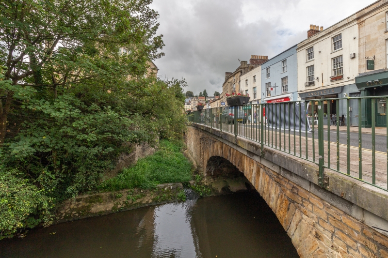
5363 THE BRIDGE
GV Bridge
ST 7748 SE 5/126 31.1.74
II
2.
Widened 1821 and reconstructed entirely at that time. Coursed and dressed rubble.
A wide elliptical-headed plain arch spans the river and there are 2 smaller similar
sub-arches at the west end, plus an etch at right angles to the Blue House, Market
Place (qv) over ditch and also a number of tunnels. Above is a terrace of houses
(included separately), now shops end a restaurant, built along one side of the
bridge over the river Frome.
Listing NGR: ST7773848131
External links are from the relevant listing authority and, where applicable, Wikidata. Wikidata IDs may be related buildings as well as this specific building. If you want to add or update a link, you will need to do so by editing the Wikidata entry.


Other nearby listed buildings
