Approximate Location Map
Large Map »
Latitude: 51.2304 / 51°13'49"N
Longitude: -2.3205 / 2°19'13"W
OS Eastings: 377717
OS Northings: 147957
OS Grid: ST777479
Mapcode National: GBR 0S9.VHL
Mapcode Global: VH97D.QBLN
Plus Code: 9C3V6MJH+4Q
Entry Name: 18, King Street
Listing Date: 31 January 1974
Grade: II
Source: Historic England
Source ID: 1173482
English Heritage Legacy ID: 266222
ID on this website: 101173482
Location: Frome, Somerset, BA11
County: Somerset
District: Mendip
Civil Parish: Frome
Built-Up Area: Frome
Traditional County: Somerset
Lieutenancy Area (Ceremonial County): Somerset
Tagged with: Building
1.
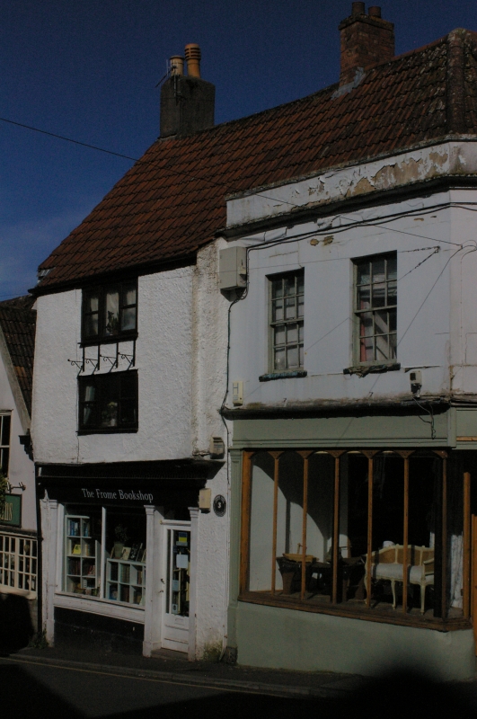
5363 KING STREET
(East side)
GV P+30 +8
ST 7747 NE 10/86A 31.1.74 No 18
II
2.
Probably of C17 origins, later alterations. Rough-cast with pantile roof 3 storeys,
the upper 2 floors overhang and each has one modern casement window. Plain mid-
late C19 shop front on ground floor.
Interior: the 1st floor has enriched plaster ceiling with Tudor rose and 2 zoomorphic
devices, Tudor-arched fireplace, beam with ogee mouldings. Scratch-mouldings on
risers of newel staircase.
Listing NGR: ST7771747957
External links are from the relevant listing authority and, where applicable, Wikidata. Wikidata IDs may be related buildings as well as this specific building. If you want to add or update a link, you will need to do so by editing the Wikidata entry.


Other nearby listed buildings
