Approximate Location Map
Large Map »
Latitude: 51.2394 / 51°14'21"N
Longitude: -2.3937 / 2°23'37"W
OS Eastings: 372612
OS Northings: 148983
OS Grid: ST726489
Mapcode National: GBR 0S6.7MZ
Mapcode Global: VH97C.G3DQ
Plus Code: 9C3V6JQ4+PG
Entry Name: Lock-Up
Listing Date: 11 March 1968
Grade: II*
Source: Historic England
Source ID: 1058320
English Heritage Legacy ID: 266749
ID on this website: 101058320
Location: Mells, Somerset, BA11
County: Somerset
District: Mendip
Civil Parish: Mells
Built-Up Area: Mells
Traditional County: Somerset
Lieutenancy Area (Ceremonial County): Somerset
Tagged with: Building
MELLS CP GAY STREET (West side)
ST7249
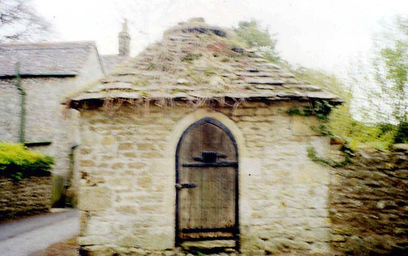
3/49 Lock-up
11.3.68
GV II*
Lock-up. C17. Doulting rubble, dressed quoins, pyramidal stone tile roof with circular stone capping. Small rectangular
structure having central pointed arch door opening in block surround; studded vertical plank door with iron surround
and strap hinges, small square peephole with hinged iron barred grille. Second inner door of similar style. An
unusually complete survival.
Listing NGR: ST7261248983
External links are from the relevant listing authority and, where applicable, Wikidata. Wikidata IDs may be related buildings as well as this specific building. If you want to add or update a link, you will need to do so by editing the Wikidata entry.


Other nearby listed buildings
