Approximate Location Map
Large Map »
Latitude: 51.2395 / 51°14'22"N
Longitude: -2.3935 / 2°23'36"W
OS Eastings: 372623
OS Northings: 148999
OS Grid: ST726489
Mapcode National: GBR 0S6.7P0
Mapcode Global: VH97C.G3HM
Plus Code: 9C3V6JQ4+RH
Entry Name: Roadside Grotto, 20 Metres North East of Lock-Up
Listing Date: 27 November 1984
Grade: II
Source: Historic England
Source ID: 1295817
English Heritage Legacy ID: 266752
ID on this website: 101295817
Location: Mells, Somerset, BA11
County: Somerset
District: Mendip
Civil Parish: Mells
Built-Up Area: Mells
Traditional County: Somerset
Lieutenancy Area (Ceremonial County): Somerset
Tagged with: Architectural structure
MELLS CP GAY STREET (East side)
ST7249
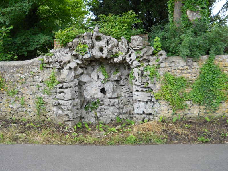
10/52 Roadside grotto, 20 metres north
east of Lock-Up
-
GV II
Roadside grotto. Circa 1800. Mostly Tufa forming irregular picturesque arch and piers. Gives onto recess similarly
faced, formerly incorporating a drinking trough, now removed. Included primarily for group value.
Listing NGR: ST7262348999
External links are from the relevant listing authority and, where applicable, Wikidata. Wikidata IDs may be related buildings as well as this specific building. If you want to add or update a link, you will need to do so by editing the Wikidata entry.


Other nearby listed buildings
