Approximate Location Map
Large Map »
Latitude: 51.2105 / 51°12'37"N
Longitude: -2.3773 / 2°22'38"W
OS Eastings: 373742
OS Northings: 145763
OS Grid: ST737457
Mapcode National: GBR 0SL.5R8
Mapcode Global: VH97C.RT3X
Plus Code: 9C3V6J6F+53
Entry Name: Market Cross
Listing Date: 27 November 1984
Grade: II*
Source: Historic England
Source ID: 1058301
English Heritage Legacy ID: 266808
ID on this website: 101058301
Location: Nunney, Somerset, BA11
County: Somerset
District: Mendip
Civil Parish: Nunney
Built-Up Area: Nunney
Traditional County: Somerset
Lieutenancy Area (Ceremonial County): Somerset
Tagged with: Market cross
ST7345 NUNNEY CP CHURCH STREET (West side)
12/110 Market Cross
-
GV II*
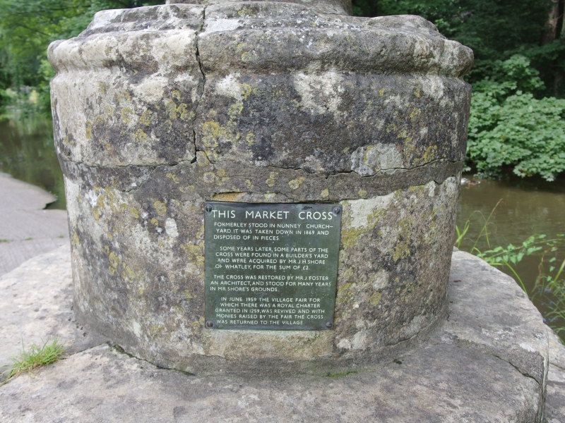
Market Cross. Circa 1100, rebuilt on present site 1959. Dressed Doulting. Circular stepped plinth, plain 4 sided shaft,
each side slightly curved, standing on cylindrical base; beading at each corner ascending to wheel head cross with
nailhead decoration. Originally stood in churchyard of Church of All Saints (qv).
Listing NGR: ST7374245763
External links are from the relevant listing authority and, where applicable, Wikidata. Wikidata IDs may be related buildings as well as this specific building. If you want to add or update a link, you will need to do so by editing the Wikidata entry.


Other nearby listed buildings
