Approximate Location Map
Large Map »
Latitude: 51.2111 / 51°12'40"N
Longitude: -2.376 / 2°22'33"W
OS Eastings: 373832
OS Northings: 145838
OS Grid: ST738458
Mapcode National: GBR 0SF.S54
Mapcode Global: VH97C.RTSD
Plus Code: 9C3V6J6F+FJ
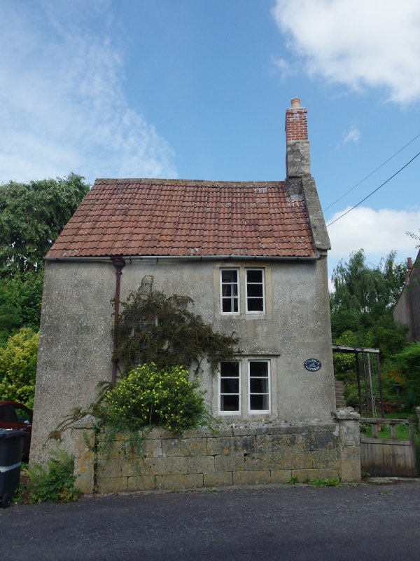
Entry Name: Fulwell Farm Cottage
Listing Date: 27 November 1984
Grade: II
Source: Historic England
Source ID: 1295691
English Heritage Legacy ID: 266811
ID on this website: 101295691
Location: Nunney, Somerset, BA11
County: Somerset
District: Mendip
Civil Parish: Nunney
Built-Up Area: Nunney
Traditional County: Somerset
Lieutenancy Area (Ceremonial County): Somerset
Tagged with: Cottage
ST7345
12/113
NUNNEY CP
FROME ROAD (North side)
Fulwell Fare Cottage
GV
II
House. Mid C18. Render, pantile roof, coped verge to right, brick and rubble stack rising through its apex. 2-storeys,
one bay, 2-light bead moulded stone mullioned windows. Right return of 3-bays, plate sash windows in plain surrounds;
door opening in similar surround, C19 door.
Listing NGR: ST7383245838
External links are from the relevant listing authority and, where applicable, Wikidata. Wikidata IDs may be related buildings as well as this specific building. If you want to add or update a link, you will need to do so by editing the Wikidata entry.


Other nearby listed buildings
