Approximate Location Map
Large Map »
Latitude: 51.1902 / 51°11'24"N
Longitude: -2.4636 / 2°27'48"W
OS Eastings: 367698
OS Northings: 143547
OS Grid: ST676435
Mapcode National: GBR MX.57N8
Mapcode Global: VH8B2.7BYX
Plus Code: 9C3V5GRP+3H
Entry Name: Pair of Gate Piers at Former Driveway Entrance to All Hallows School
Listing Date: 25 February 1988
Grade: II
Source: Historic England
Source ID: 1345162
English Heritage Legacy ID: 268269
ID on this website: 101345162
Location: East Cranmore, Somerset, BA4
County: Somerset
District: Mendip
Civil Parish: Cranmore
Traditional County: Somerset
Lieutenancy Area (Ceremonial County): Somerset
Tagged with: Gatepost
CRANMORE CP EAST CRANMORE
ST64SE
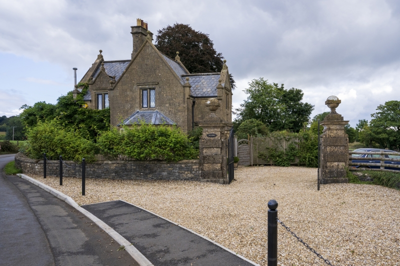
4/69 Pair of gate piers at former
driveway entrance to All Hallows
- School
- II
Pair of gate piers. C18. Ashlar. Tall rustricated piers with fluting, cornices, ball caps.
Listing NGR: ST6769843547
External links are from the relevant listing authority and, where applicable, Wikidata. Wikidata IDs may be related buildings as well as this specific building. If you want to add or update a link, you will need to do so by editing the Wikidata entry.


Other nearby listed buildings
