Approximate Location Map
Large Map »
Latitude: 51.0921 / 51°5'31"N
Longitude: -2.8917 / 2°53'30"W
OS Eastings: 337646
OS Northings: 132910
OS Grid: ST376329
Mapcode National: GBR MB.CF73
Mapcode Global: FRA 46T7.K86
Plus Code: 9C3V34R5+R8
Entry Name: Merricks Farmhouse
Listing Date: 24 June 1987
Grade: II
Source: Historic England
Source ID: 1295956
English Heritage Legacy ID: 269557
ID on this website: 101295956
Location: Middlezoy, Somerset, TA7
County: Somerset
District: Sedgemoor
Civil Parish: Middlezoy
Built-Up Area: Middlezoy
Traditional County: Somerset
Lieutenancy Area (Ceremonial County): Somerset
Tagged with: Farmhouse
MIDDLEZOY CP MAIN ROAD (East side)
ST33SE
5/35 No 46
(Merricks Farmhouse)
-
- II
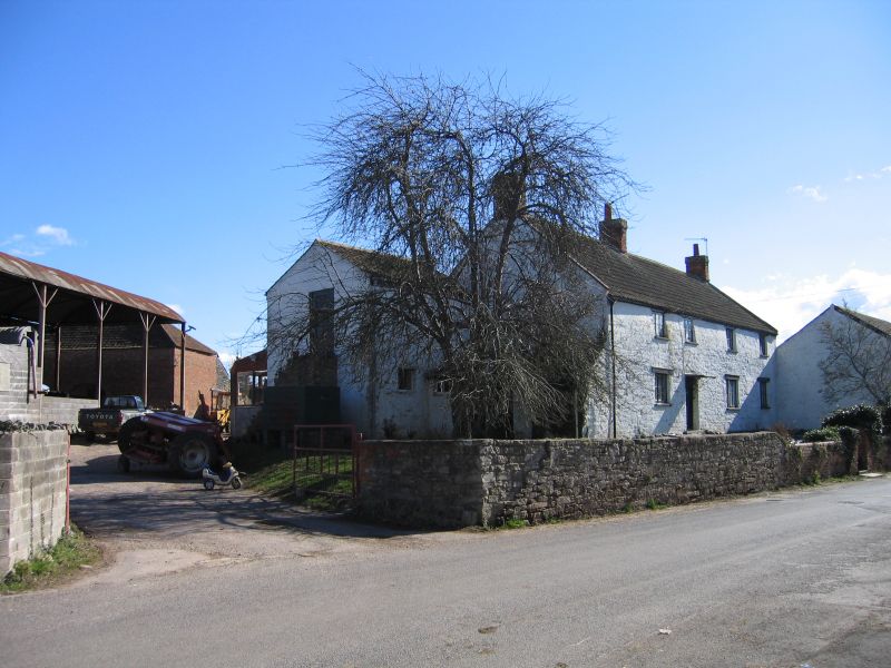
Farmhouse. C19 features though core earlier. Colourwashed rubble, double-Roman tile roof, coped verges, brick stacks.
Two storeys, 4 bays, 3-light casements with horizontal glazing bars, on ground floor with wooden lintols. Door opening
to second bay from left, plank door, flat hood on ornamental wrought-iron brackets.
Listing NGR: ST3764632910
External links are from the relevant listing authority and, where applicable, Wikidata. Wikidata IDs may be related buildings as well as this specific building. If you want to add or update a link, you will need to do so by editing the Wikidata entry.


Other nearby listed buildings
