Approximate Location Map
Large Map »
Latitude: 51.0173 / 51°1'2"N
Longitude: -3.0992 / 3°5'57"W
OS Eastings: 322990
OS Northings: 124787
OS Grid: ST229247
Mapcode National: GBR M1.J8MS
Mapcode Global: FRA 46DF.8DY
Plus Code: 9C3R2W82+W8
Entry Name: Barton House
Listing Date: 4 June 1952
Grade: II
Source: Historic England
Source ID: 1060072
English Heritage Legacy ID: 269646
ID on this website: 101060072
Location: Firepool, Somerset, TA1
County: Somerset
District: Somerset West and Taunton
Electoral Ward/Division: Taunton Eastgate
Parish: Non Civil Parish
Built-Up Area: Taunton
Traditional County: Somerset
Lieutenancy Area (Ceremonial County): Somerset
Tagged with: House
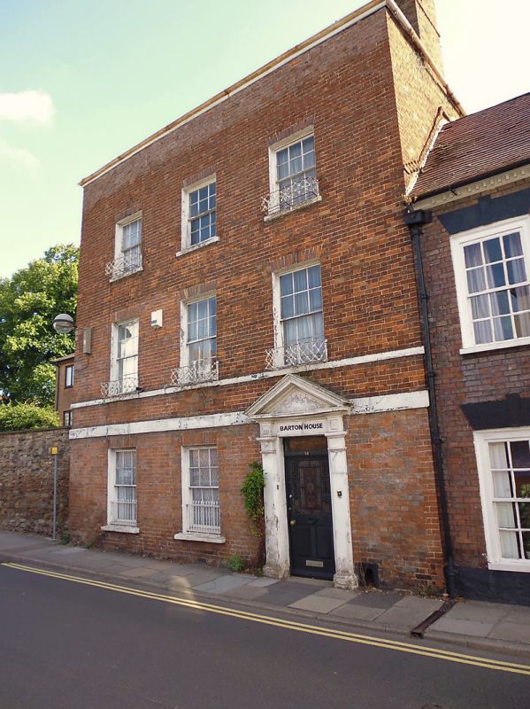
1. CANON STREET
5365
(East Side)
ST 2224 NE 9/29 No 18 (Barton House)
4.6.52.
II
GV
2.
3 storey 3 window C18 red brick front. Hipped old tile roof. Sill band to 1st
floor and string course to ground floor. Sashes with glazing bars in painted reveals.
Window-box rails to upper windows. Tuscan doorcase with open pediment. 6-panel
door.
Nos 17 to 22 (consec) together with the Priory and Walls form a good group.
Listing NGR: ST2299224790
External links are from the relevant listing authority and, where applicable, Wikidata. Wikidata IDs may be related buildings as well as this specific building. If you want to add or update a link, you will need to do so by editing the Wikidata entry.


Other nearby listed buildings
