Approximate Location Map
Large Map »
Latitude: 51.0122 / 51°0'43"N
Longitude: -3.1033 / 3°6'11"W
OS Eastings: 322695
OS Northings: 124222
OS Grid: ST226242
Mapcode National: GBR M1.JFMF
Mapcode Global: FRA 46DF.LV5
Plus Code: 9C3R2V6W+VM
Entry Name: 31A and 32, High Street
Listing Date: 17 December 1973
Last Amended: 4 July 1975
Grade: II
Source: Historic England
Source ID: 1060001
English Heritage Legacy ID: 269768
ID on this website: 101060001
Location: Taunton, Somerset, TA1
County: Somerset
District: Somerset West and Taunton
Electoral Ward/Division: Taunton Manor and Wilton
Parish: Non Civil Parish
Built-Up Area: Taunton
Traditional County: Somerset
Lieutenancy Area (Ceremonial County): Somerset
Tagged with: Building
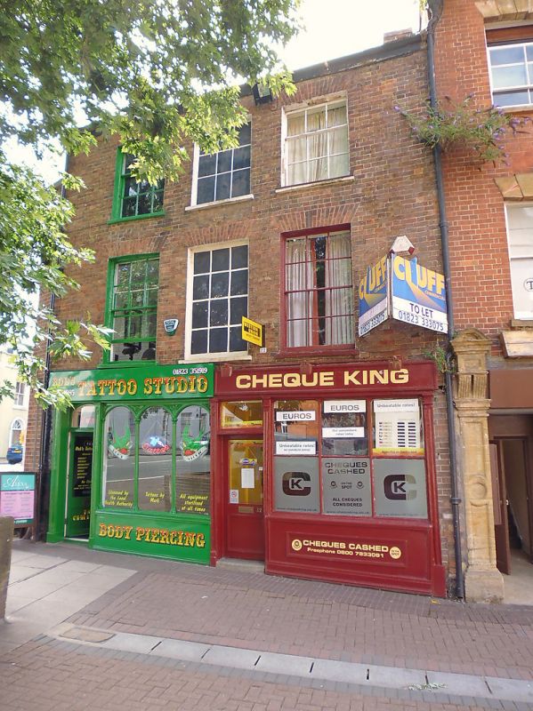
1. HIGH STREET
5365
(West Side)
Nos 31A & 32.
( formerly listed as No 32)
ST 2224 SE 11/94 17.12.75.
II GV
2.
1 building. 3 storey early Cl9 brown brick front. Old tile roof. 3 windows (centr
e 1 painted only), sashes with glazing bars. 2 small shop fronts with original
glazing divisions.
Nos 31A, 32, 33, 33A and 34 form a group.
Listing NGR: ST2269524222
External links are from the relevant listing authority and, where applicable, Wikidata. Wikidata IDs may be related buildings as well as this specific building. If you want to add or update a link, you will need to do so by editing the Wikidata entry.


Other nearby listed buildings
