Approximate Location Map
Large Map »
Latitude: 51.0125 / 51°0'45"N
Longitude: -3.1036 / 3°6'13"W
OS Eastings: 322675
OS Northings: 124260
OS Grid: ST226242
Mapcode National: GBR M1.JFK3
Mapcode Global: FRA 46DF.LQR
Plus Code: 9C3R2V7W+2H
Entry Name: 37, High Street
Listing Date: 17 December 1973
Grade: II
Source: Historic England
Source ID: 1276818
English Heritage Legacy ID: 269771
ID on this website: 101276818
Location: Taunton, Somerset, TA1
County: Somerset
District: Somerset West and Taunton
Electoral Ward/Division: Taunton Manor and Wilton
Parish: Non Civil Parish
Built-Up Area: Taunton
Traditional County: Somerset
Lieutenancy Area (Ceremonial County): Somerset
Tagged with: Building
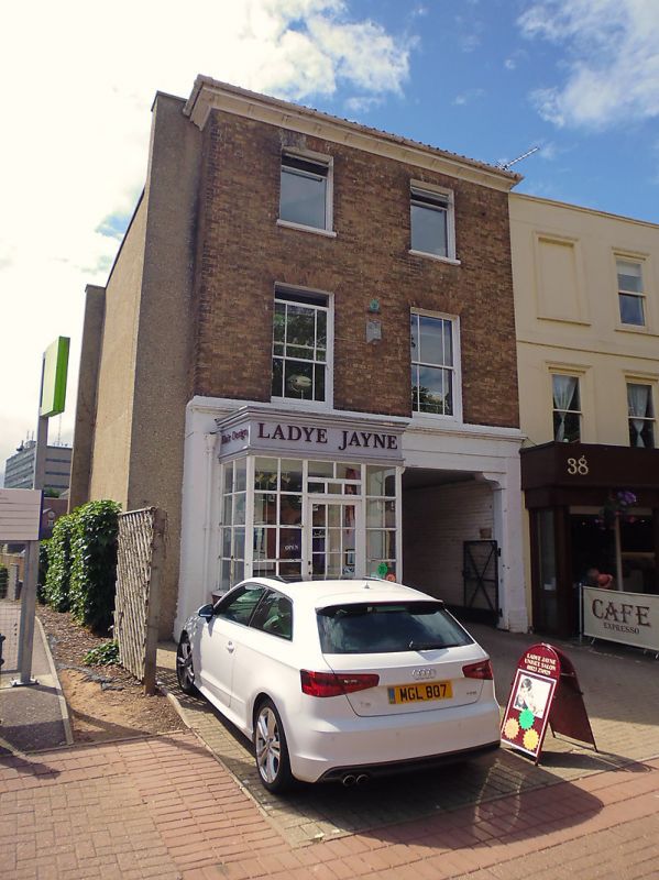
HIGH STREET
l.
5365
(West Side)
No 37
ST 2224 SE 11/272 17.12.73.
II GV
2.
Plain 3 storey early/ C19 brown brick front, flipped pantile roof with eaves brackets
2 windows, sashes with some glazing bars. Modern projecting shop front with plain
carriage entry to righ., Included for group value.
Nos 37 to 40 (consec) form a group
Listing NGR: ST2267524260
External links are from the relevant listing authority and, where applicable, Wikidata. Wikidata IDs may be related buildings as well as this specific building. If you want to add or update a link, you will need to do so by editing the Wikidata entry.


Other nearby listed buildings
