Approximate Location Map
Large Map »
Latitude: 51.0131 / 51°0'47"N
Longitude: -3.1036 / 3°6'13"W
OS Eastings: 322675
OS Northings: 124326
OS Grid: ST226243
Mapcode National: GBR M1.JFJX
Mapcode Global: FRA 46DF.LPD
Plus Code: 9C3R2V7W+6G
Entry Name: 48-50, High Street
Listing Date: 17 December 1973
Grade: II
Source: Historic England
Source ID: 1344721
English Heritage Legacy ID: 269775
ID on this website: 101344721
Location: Taunton, Somerset, TA1
County: Somerset
District: Somerset West and Taunton
Electoral Ward/Division: Taunton Manor and Wilton
Parish: Non Civil Parish
Built-Up Area: Taunton
Traditional County: Somerset
Lieutenancy Area (Ceremonial County): Somerset
Tagged with: Building
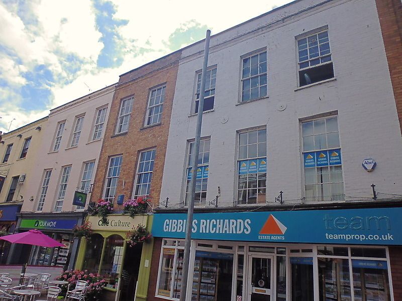
HIGH STREET
l.
5365
(West Side)
Nos 48 to 50 (consec)
ST 2224 SE 11/99 17.12.75.
II
2.
3 storey early Cl9 brown brick fronts, partly minted. Cornice and parapets. 8
well- spaced tall sash windows, glazing bars. Modern shop fronts. Included as
a group.
Listing NGR: ST2267524326
External links are from the relevant listing authority and, where applicable, Wikidata. Wikidata IDs may be related buildings as well as this specific building. If you want to add or update a link, you will need to do so by editing the Wikidata entry.


Other nearby listed buildings
