Approximate Location Map
Large Map »
Latitude: 51.0127 / 51°0'45"N
Longitude: -3.0959 / 3°5'45"W
OS Eastings: 323219
OS Northings: 124274
OS Grid: ST232242
Mapcode National: GBR M1.JHHY
Mapcode Global: FRA 46DF.PQN
Plus Code: 9C3R2W73+3M
Entry Name: Southfield
Listing Date: 4 July 1975
Grade: II
Source: Historic England
Source ID: 1059964
English Heritage Legacy ID: 269881
ID on this website: 101059964
Location: Taunton, Somerset, TA1
County: Somerset
District: Somerset West and Taunton
Electoral Ward/Division: Taunton Eastgate
Parish: Non Civil Parish
Built-Up Area: Taunton
Traditional County: Somerset
Lieutenancy Area (Ceremonial County): Somerset
Tagged with: Building
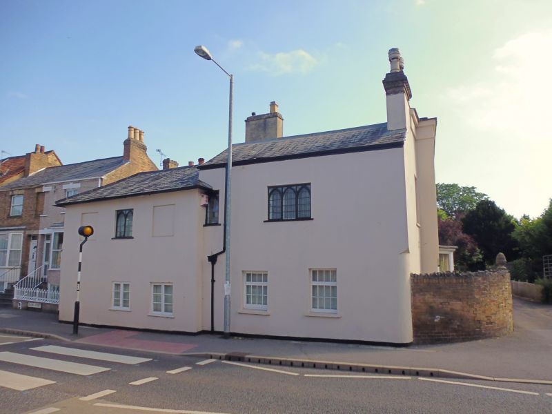
1. SOUTH ROAD
5365
(East Side)
Nos 1 & 3 (Southfield)
ST 2324 SW 14/145
II
2.
2 storey 7 window stucco front at right angles to road. Front has treatment of
recessed panels. Parapet swept up in centre. 1st floor windows have segmental
heads and sashes with Gothic glazing bars. 4 Flight canted bays and large porch
to ground floor. Gothic casements to road front. Probably dates from 1820-30,
with alterations.
Listing NGR: ST2321924274
External links are from the relevant listing authority and, where applicable, Wikidata. Wikidata IDs may be related buildings as well as this specific building. If you want to add or update a link, you will need to do so by editing the Wikidata entry.


Other nearby listed buildings
