Approximate Location Map
Large Map »
Latitude: 52.7595 / 52°45'34"N
Longitude: -1.935 / 1°56'6"W
OS Eastings: 404481
OS Northings: 317987
OS Grid: SK044179
Mapcode National: GBR 3B6.X6C
Mapcode Global: WHBF3.7WTW
Plus Code: 9C4WQ357+QX
Entry Name: Brook House
Listing Date: 5 July 1972
Grade: II
Source: Historic England
Source ID: 1178115
English Heritage Legacy ID: 271244
ID on this website: 101178115
Location: Rugeley, Cannock Chase, Staffordshire, WS15
County: Staffordshire
District: Cannock Chase
Civil Parish: Rugeley
Built-Up Area: Rugeley
Traditional County: Staffordshire
Lieutenancy Area (Ceremonial County): Staffordshire
Church of England Parish: Brereton and Rugeley
Church of England Diocese: Lichfield
Tagged with: House
1.
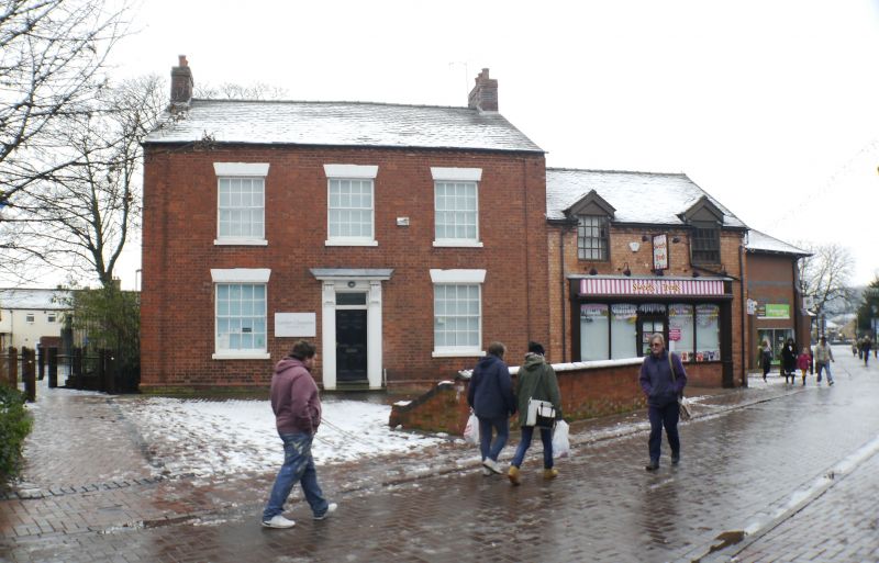
1571 BREWERY STREET
Brook House
SK 0417 2/18
II
2.
Early C19. Red brick; 2 storeys; 3 sash windows with chanelled lintels;
moulded stucco pilaster doorcase with cornice hood on consoles; plain eaves;
slates.
Listing NGR: SK0448117987
External links are from the relevant listing authority and, where applicable, Wikidata. Wikidata IDs may be related buildings as well as this specific building. If you want to add or update a link, you will need to do so by editing the Wikidata entry.


Other nearby listed buildings
