Approximate Location Map
Large Map »
Latitude: 52.7646 / 52°45'52"N
Longitude: -1.9349 / 1°56'5"W
OS Eastings: 404489
OS Northings: 318552
OS Grid: SK044185
Mapcode National: GBR 3B6.PM4
Mapcode Global: WHBF3.7RWZ
Plus Code: 9C4WQ378+R2
Entry Name: Graveyard Wall of Old Church of St Augustine
Listing Date: 5 July 1972
Grade: II
Source: Historic England
Source ID: 1060247
English Heritage Legacy ID: 271252
ID on this website: 101060247
Location: Rugeley, Cannock Chase, Staffordshire, WS15
County: Staffordshire
District: Cannock Chase
Civil Parish: Rugeley
Built-Up Area: Rugeley
Traditional County: Staffordshire
Lieutenancy Area (Ceremonial County): Staffordshire
Church of England Parish: Brereton and Rugeley
Church of England Diocese: Lichfield
Tagged with: Wall
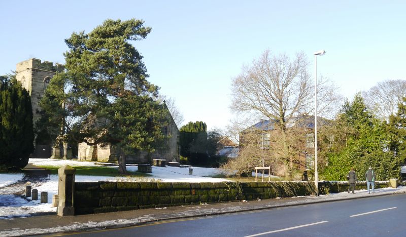
1.
1571 COLTON ROAD
Graveyard wall of
old Church of
St Augustine
SK 0418 1/3A
II
2.
A low wall of stone, probably from the demolished church, on the east side
of graveyard.
Listing NGR: SK0449018551
External links are from the relevant listing authority and, where applicable, Wikidata. Wikidata IDs may be related buildings as well as this specific building. If you want to add or update a link, you will need to do so by editing the Wikidata entry.


Other nearby listed buildings
