Approximate Location Map
Large Map »
Latitude: 52.7434 / 52°44'36"N
Longitude: -1.92 / 1°55'11"W
OS Eastings: 405499
OS Northings: 316195
OS Grid: SK054161
Mapcode National: GBR 3BF.TNM
Mapcode Global: WHBF9.G9YQ
Plus Code: 9C4WP3VJ+82
Entry Name: Brereton House
Listing Date: 4 May 1951
Grade: II
Source: Historic England
Source ID: 1060211
English Heritage Legacy ID: 271265
ID on this website: 101060211
Location: Brereton, Cannock Chase, Staffordshire, WS15
County: Staffordshire
District: Cannock Chase
Civil Parish: Brereton and Ravenhill
Built-Up Area: Rugeley
Traditional County: Staffordshire
Lieutenancy Area (Ceremonial County): Staffordshire
Church of England Parish: Brereton and Rugeley
Church of England Diocese: Lichfield
Tagged with: House
1.
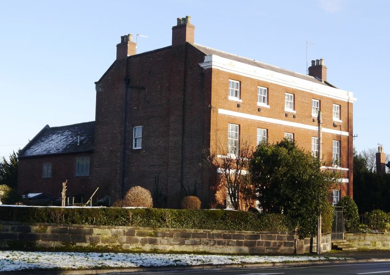
1571 MAIN ROAD, BRERETON
Brereton House
SK 01 NE 4/1 1.5.51.
II
2.
Late C18. Red brick; 3 storeys; 5 sash windows; stuccoed Tuscan doorcase
with moulded pediment and triglyphs on frieze; bands; plain pilasters at
sides; moulded plaster eaves; blocking course.
Listing NGR: SK0549916195
External links are from the relevant listing authority and, where applicable, Wikidata. Wikidata IDs may be related buildings as well as this specific building. If you want to add or update a link, you will need to do so by editing the Wikidata entry.


Other nearby listed buildings
