Approximate Location Map
Large Map »
Latitude: 52.7592 / 52°45'33"N
Longitude: -2.0702 / 2°4'12"W
OS Eastings: 395361
OS Northings: 317956
OS Grid: SJ953179
Mapcode National: GBR 28W.5F6
Mapcode Global: WHBF1.5XG3
Plus Code: 9C4VQW5H+MW
Entry Name: Barn Incorporating Cowhouse Approximately 5 Yards North of Lower Farmhouse
Listing Date: 2 January 1986
Grade: II
Source: Historic England
Source ID: 1039249
English Heritage Legacy ID: 271663
ID on this website: 101039249
Location: Bednall, South Staffordshire, ST17
County: Staffordshire
District: South Staffordshire
Civil Parish: Acton Trussell and Bednall
Traditional County: Staffordshire
Lieutenancy Area (Ceremonial County): Staffordshire
Church of England Parish: Acton Trussell St James
Church of England Diocese: Lichfield
SJ 91 NE ACTON TRUSSELL, BEDNALL BEDNALL
AND TEDDESLEY HAY C.P.
4/15 Barn incorporating cowhouse
- approximately 5 yards
north of Lower Farmhouse
- II
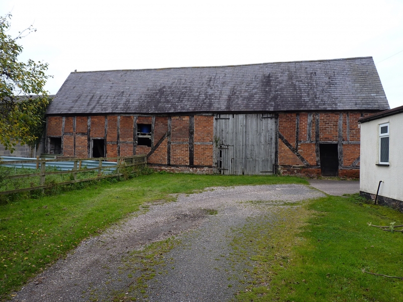
Barn and cowhouse. Early C18. Timber framed with brick infill; slate
roof. 4-bay range aligned north-west/south-east, cowhouse in the north-
west bay and barn with central threshing floor to the south-east. One
storey; full height 2-leaf barn door to right of centre, boarded doors
to left serving cowhouse and barn, inserted doorway to right. Framing:
2 panels to eaves, the barn has square panels below and vertical rectangular
panels above, on the cowhouse the positions are reversed, long straight
tension braces. Interior: The cross-frames have central vertical posts
between sill-beam and tie-beam, the roof trusses have angle struts
extending from tie-beam to principal rafters, 2 pairs of purlins and a
ridge piece. Lower Farmhouse is not included in this list. J.E.C. Peters
The Development of Farm Buildings in Western Lowland Staffordshire up
to 1880 (1969). Manchester University Press. PP 97, 113, Fig. 3.
Listing NGR: SJ9536117956
External links are from the relevant listing authority and, where applicable, Wikidata. Wikidata IDs may be related buildings as well as this specific building. If you want to add or update a link, you will need to do so by editing the Wikidata entry.


Other nearby listed buildings
