Approximate Location Map
Large Map »
Latitude: 52.7215 / 52°43'17"N
Longitude: -2.1279 / 2°7'40"W
OS Eastings: 391458
OS Northings: 313773
OS Grid: SJ914137
Mapcode National: GBR 17W.8V6
Mapcode Global: WHBF6.8VZG
Plus Code: 9C4VPVCC+JR
Entry Name: Cuttlestone Bridge
Listing Date: 19 March 1962
Grade: II
Source: Historic England
Source ID: 1039217
English Heritage Legacy ID: 271689
ID on this website: 101039217
Location: South Staffordshire, ST19
County: Staffordshire
District: South Staffordshire
Civil Parish: Penkridge
Traditional County: Staffordshire
Lieutenancy Area (Ceremonial County): Staffordshire
Church of England Parish: Penkridge St Michael and All Angels
Church of England Diocese: Lichfield
Tagged with: Road bridge
This list entry was subject to a Minor Amendment on 21/05/2020
SJ 91 SW
6/40
PENKRIDGE C.P.
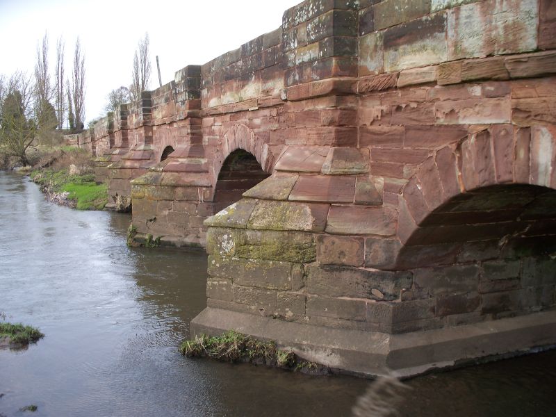
Cuttlestone Bridge
19.3.62
II
Road bridge. C18. Ashlar. Five semi-circular arches spanning the River Penk; four cutwaters carried upwards as buttresses; parapet band to plain parapet terminating in piers of square section.
Listing NGR: SJ9145813773
External links are from the relevant listing authority and, where applicable, Wikidata. Wikidata IDs may be related buildings as well as this specific building. If you want to add or update a link, you will need to do so by editing the Wikidata entry.


Other nearby listed buildings
