Approximate Location Map
Large Map »
Latitude: 52.7396 / 52°44'22"N
Longitude: -2.1003 / 2°6'1"W
OS Eastings: 393322
OS Northings: 315776
OS Grid: SJ933157
Mapcode National: GBR 291.9SC
Mapcode Global: WHBF6.QD1M
Plus Code: 9C4VPVQX+RV
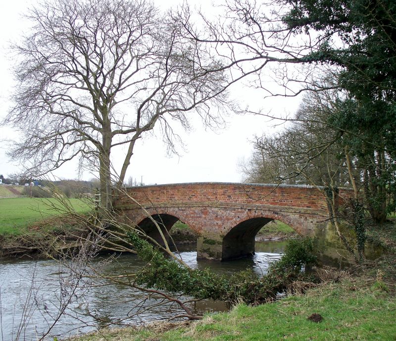
Entry Name: Lower Drayton Bridge
Listing Date: 2 January 1986
Grade: II
Source: Historic England
Source ID: 1039226
English Heritage Legacy ID: 271709
ID on this website: 101039226
Location: Lower Drayton, South Staffordshire, ST19
County: Staffordshire
District: South Staffordshire
Civil Parish: Penkridge
Traditional County: Staffordshire
Lieutenancy Area (Ceremonial County): Staffordshire
Church of England Parish: Penkridge St Michael and All Angels
Church of England Diocese: Lichfield
Tagged with: Bridge
SJ 91 NW PENKRIDGE C.P. LOWER DRAYTON
3/60 Lower Drayton Bridge
-
- II
Bridge. Late C18 with mid C19 alterations. Red brick on ashlar
plinth. 2 semi-circular arches spanning the river Penk; parapet
band and plain parapet.
Listing NGR: SJ9332215776
External links are from the relevant listing authority and, where applicable, Wikidata. Wikidata IDs may be related buildings as well as this specific building. If you want to add or update a link, you will need to do so by editing the Wikidata entry.


Other nearby listed buildings
