Approximate Location Map
Large Map »
Latitude: 52.7253 / 52°43'31"N
Longitude: -2.1186 / 2°7'6"W
OS Eastings: 392086
OS Northings: 314194
OS Grid: SJ920141
Mapcode National: GBR 17W.566
Mapcode Global: WHBF6.FRCK
Plus Code: 9C4VPVGJ+4H
Entry Name: Church Farm
Listing Date: 2 January 1986
Grade: II
Source: Historic England
Source ID: 1294928
English Heritage Legacy ID: 271733
ID on this website: 101294928
Location: Penkridge, South Staffordshire, ST19
County: Staffordshire
District: South Staffordshire
Civil Parish: Penkridge
Built-Up Area: Penkridge
Traditional County: Staffordshire
Lieutenancy Area (Ceremonial County): Staffordshire
Church of England Parish: Penkridge St Michael and All Angels
Church of England Diocese: Lichfield
Tagged with: Agricultural structure
SJ 9214-9314
9/84
PENKRIDGE C.P.
PINFOLD LANE (south-west side)
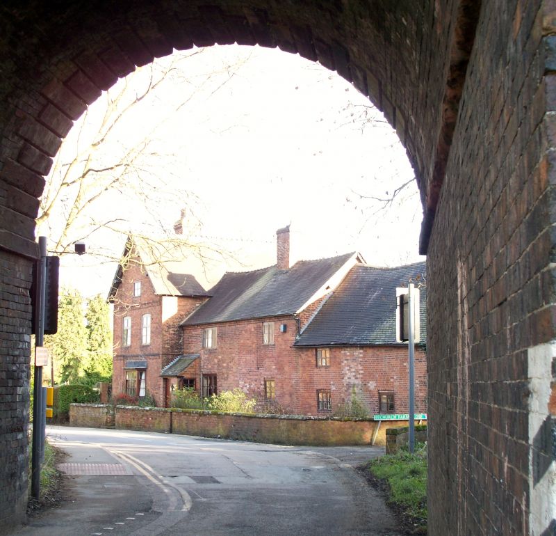
Church Farm
GV
II
House. Probably C15 with early C18 additions and rebuilding. Red brick replacing timber frame; plain tile roof; brick ridge stack and integral end stack.
T-shaped plan; a two-bay building containing the remains of the C15 house aligned north-east/south-west with an early C18 extension, possibly a malt house, to the south-west, on the same alignment and an early C18 crosswing to the north-east aligned north-west/south-east; a cottage extension projects south-east from the malt house.
In three parts, gabled crosswing to the left of two storeys and attic with floor bands, two-storey central range with eaves band, and slightly lower two-storey malt house extension to the right.
Crosswing: two windows, casements with segmental heads, mid-C19 bay window to ground floor right, central attic window with straight head.
Central range: two windows, casements; C20 lean-to porch to the left.
Malt house: Casements to ground floor left and right and first floor left.
Interior: Chamfered and stopped ceiling beams; several early C18 doors; cross-wing contains dog-leg staircase with turned balusters and moulded hand rail; south-west bay of central range enclosed by two cruck trusses with curved wind braces, north-east bay has a C16 sandstone fireplace with chamfered and stopped timber bresummer; malt house roof has angle struts extending from tie beam to principals.
Church Farm no longer functions as a farm, the address referring to the house only.
Listing NGR: SJ9208614194
External links are from the relevant listing authority and, where applicable, Wikidata. Wikidata IDs may be related buildings as well as this specific building. If you want to add or update a link, you will need to do so by editing the Wikidata entry.


Other nearby listed buildings
