Approximate Location Map
Large Map »
Latitude: 52.6913 / 52°41'28"N
Longitude: -2.1197 / 2°7'11"W
OS Eastings: 392003
OS Northings: 310403
OS Grid: SJ920104
Mapcode National: GBR 188.BWT
Mapcode Global: WHBFD.DMT5
Plus Code: 9C4VMVRJ+G4
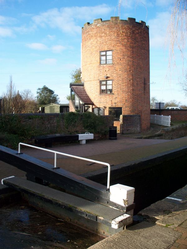
Entry Name: The Round House
Listing Date: 23 May 1985
Grade: II
Source: Historic England
Source ID: 1188285
English Heritage Legacy ID: 271762
ID on this website: 101188285
Location: Gailey, South Staffordshire, ST19
County: Staffordshire
District: South Staffordshire
Civil Parish: Penkridge
Traditional County: Staffordshire
Lieutenancy Area (Ceremonial County): Staffordshire
Church of England Parish: Penkridge St Michael and All Angels
Church of England Diocese: Lichfield
Tagged with: House
SJ 91 SW PENKRIDGE C.P. WATLING STREET (South side)
6/113 The Round House
23.5.85
GV II
Former lock keeper's house. C18 with later alterations. Red brick; brick
stack. Circular plan. 2 storeys with castellated parapet and chimney
carried up as a turret; C20 casements. The Round contributes to a
picturesque grouping of buildings around Gailey Wharf.
Listing NGR: SJ9200310403
External links are from the relevant listing authority and, where applicable, Wikidata. Wikidata IDs may be related buildings as well as this specific building. If you want to add or update a link, you will need to do so by editing the Wikidata entry.


Other nearby listed buildings
