Approximate Location Map
Large Map »
Latitude: 52.857 / 52°51'25"N
Longitude: -2.2085 / 2°12'30"W
OS Eastings: 386060
OS Northings: 328851
OS Grid: SJ860288
Mapcode National: GBR 161.SKC
Mapcode Global: WHBDL.1GM4
Plus Code: 9C4VVQ4R+QJ
Entry Name: The Mount
Listing Date: 25 April 1980
Grade: II
Source: Historic England
Source ID: 1039086
English Heritage Legacy ID: 272111
ID on this website: 101039086
Location: Chebsey, Stafford, Staffordshire, ST21
County: Staffordshire
District: Stafford
Civil Parish: Chebsey
Traditional County: Staffordshire
Lieutenancy Area (Ceremonial County): Staffordshire
Church of England Parish: Chebsey All Saints
Church of England Diocese: Lichfield
Tagged with: Building
CHEBSEY CHEBSEY
1.
5373
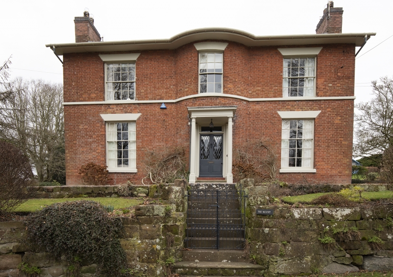
The Mount
SJ 82 NE 14/2
II
2.
Early C19 house. Red brick; 2 storeys; sash and casement windows; 3 window
front; convex centre to front; sill band; plain wood doorcase with modern door,
and porch with Tuscan columns; projecting eaves; slates.
Listing NGR: SJ8606028851
External links are from the relevant listing authority and, where applicable, Wikidata. Wikidata IDs may be related buildings as well as this specific building. If you want to add or update a link, you will need to do so by editing the Wikidata entry.


Other nearby listed buildings
