Approximate Location Map
Large Map »
Latitude: 52.9129 / 52°54'46"N
Longitude: -2.1326 / 2°7'57"W
OS Eastings: 391178
OS Northings: 335059
OS Grid: SJ911350
Mapcode National: GBR 15K.7NS
Mapcode Global: WHBDF.61QR
Plus Code: 9C4VWV78+5X
Entry Name: Hayes Mill
Listing Date: 25 September 1979
Grade: II
Source: Historic England
Source ID: 1190141
English Heritage Legacy ID: 272344
ID on this website: 101190141
Location: Oultoncross, Stafford, Staffordshire, ST15
County: Staffordshire
District: Stafford
Civil Parish: Stone Rural
Traditional County: Staffordshire
Lieutenancy Area (Ceremonial County): Staffordshire
Church of England Parish: Oulton St John the Evangelist
Church of England Diocese: Lichfield
Tagged with: Mill
STONE RURAL NICHOLL'S LANE
1.
5373
Oulton
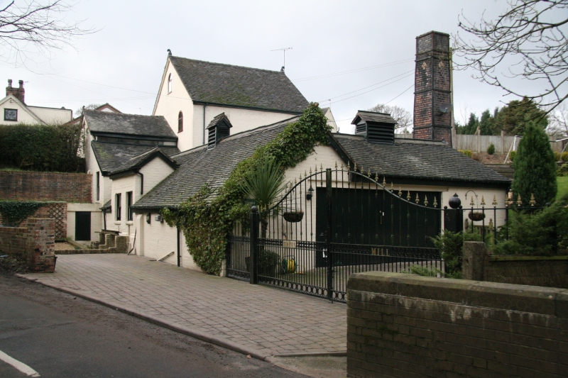
SJ 93 NW 6/5 25.9.79. Hayes Mill
II
2.
Early C19 bone grinding mill. Brick with tiled roofs; irregular. Mill building
to west is 2-storeyed and contains working machinery including drive shafts and
2 grinding pans (one disused) and disused overshot waterwheel. One of the few
bone mills still operating in North Staffordshire.
Listing NGR: SJ9117835059
External links are from the relevant listing authority and, where applicable, Wikidata. Wikidata IDs may be related buildings as well as this specific building. If you want to add or update a link, you will need to do so by editing the Wikidata entry.


Other nearby listed buildings
