Approximate Location Map
Large Map »
Latitude: 52.9183 / 52°55'5"N
Longitude: -2.2219 / 2°13'18"W
OS Eastings: 385179
OS Northings: 335672
OS Grid: SJ851356
Mapcode National: GBR 15F.32D
Mapcode Global: WHBD5.VX45
Plus Code: 9C4VWQ9H+87
Entry Name: The Thatched Cottage
Listing Date: 25 April 1980
Grade: II
Source: Historic England
Source ID: 1374207
English Heritage Legacy ID: 272383
ID on this website: 101374207
Location: Swynnerton, Stafford, Staffordshire, ST15
County: Staffordshire
District: Stafford
Civil Parish: Swynnerton
Built-Up Area: Swynnerton
Traditional County: Staffordshire
Lieutenancy Area (Ceremonial County): Staffordshire
Church of England Parish: Swynnerton and Cotes Heath
Church of England Diocese: Lichfield
Tagged with: Cottage Thatched cottage
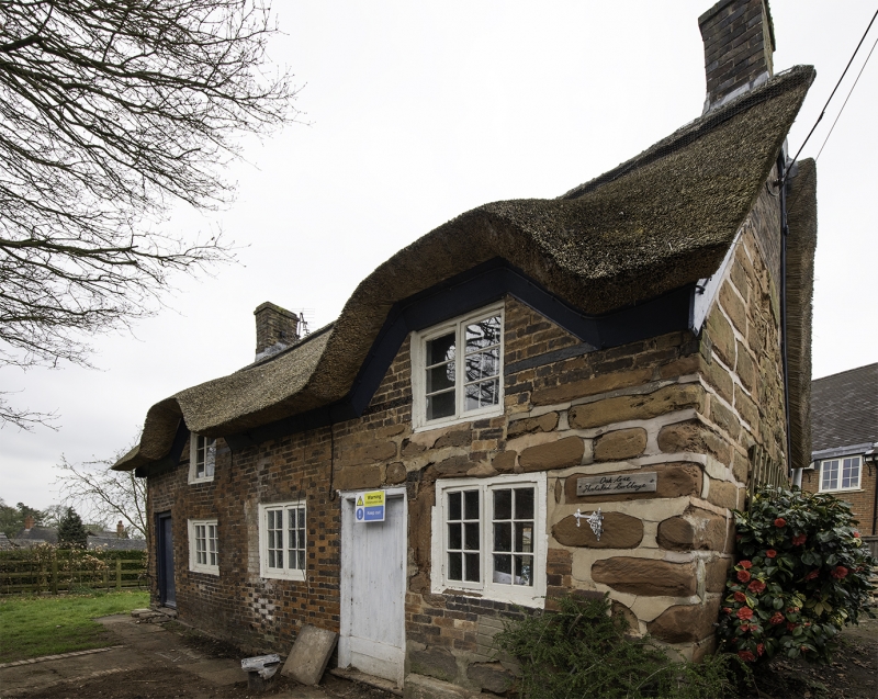
SWYNNERTON SWYNNERTON
1.
5373
The Thatched Cottage
SJ 83 NE 5/21
II
2.
Probably C17. Stone and brick; 2 storeys; 3 casement windows; thatched roof with
2 small windows with 'eye-brows' at eaves.
Listing NGR: SJ8517835671
External links are from the relevant listing authority and, where applicable, Wikidata. Wikidata IDs may be related buildings as well as this specific building. If you want to add or update a link, you will need to do so by editing the Wikidata entry.


Other nearby listed buildings
