Approximate Location Map
Large Map »
Latitude: 52.8991 / 52°53'56"N
Longitude: -1.8651 / 1°51'54"W
OS Eastings: 409171
OS Northings: 333524
OS Grid: SK091335
Mapcode National: GBR 38R.991
Mapcode Global: WHCFP.BD3B
Plus Code: 9C4WV4XM+JX
Entry Name: 22 and 24, High Street
Listing Date: 26 March 1973
Grade: II
Source: Historic England
Source ID: 1190931
English Heritage Legacy ID: 272916
ID on this website: 101190931
Location: Uttoxeter, East Staffordshire, ST14
County: Staffordshire
District: East Staffordshire
Civil Parish: Uttoxeter
Built-Up Area: Uttoxeter
Traditional County: Staffordshire
Lieutenancy Area (Ceremonial County): Staffordshire
Church of England Parish: Uttoxeter St Mary Virgin
Church of England Diocese: Lichfield
Tagged with: Building
HIGH STREET
1.
1756
(East Side)
Nos 22 and 24
SK 0933 1/87
II
2.
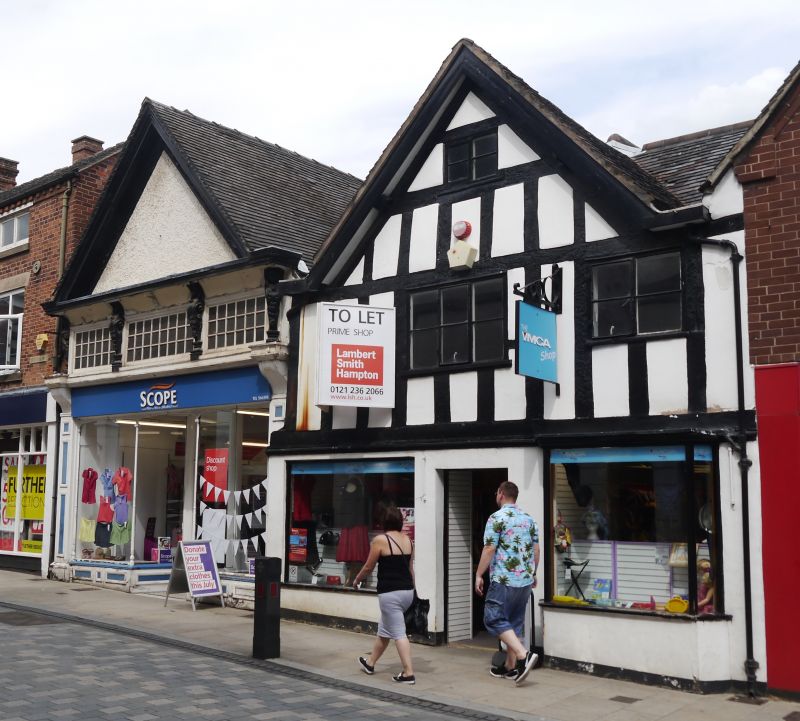
C17. Timber frame and plaster; 2 storeys and attic; 2 later casement windows
inserted, mutilating timber frame; gable overall with restored barge boards;
tiles. Modern shop front.
Listing NGR: SK0917133524
External links are from the relevant listing authority and, where applicable, Wikidata. Wikidata IDs may be related buildings as well as this specific building. If you want to add or update a link, you will need to do so by editing the Wikidata entry.


Other nearby listed buildings
