Approximate Location Map
Large Map »
Latitude: 52.8995 / 52°53'58"N
Longitude: -1.8657 / 1°51'56"W
OS Eastings: 409129
OS Northings: 333575
OS Grid: SK091335
Mapcode National: GBR 38R.93D
Mapcode Global: WHCFP.9CTZ
Plus Code: 9C4WV4XM+RP
Entry Name: 23, High Street
Listing Date: 26 March 1973
Grade: II
Source: Historic England
Source ID: 1190996
English Heritage Legacy ID: 272926
ID on this website: 101190996
Location: Uttoxeter, East Staffordshire, ST14
County: Staffordshire
District: East Staffordshire
Civil Parish: Uttoxeter
Built-Up Area: Uttoxeter
Traditional County: Staffordshire
Lieutenancy Area (Ceremonial County): Staffordshire
Church of England Parish: Uttoxeter St Mary Virgin
Church of England Diocese: Lichfield
Tagged with: Building
HIGH STREET
1.
1756
(West Side)
No 23
SK 0933 1/57
II
2.
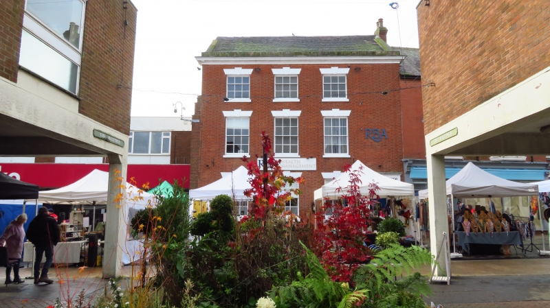
Late C18. Red brick; 3 storeys; 3 sash windows with keyblocks and channelled
lintels; segmental-headed passage-way on right-hand side replaced by modern
doorway with moulded stone surround; moulded plaster eaves cornice.
Listing NGR: SK0912933575
External links are from the relevant listing authority and, where applicable, Wikidata. Wikidata IDs may be related buildings as well as this specific building. If you want to add or update a link, you will need to do so by editing the Wikidata entry.


Other nearby listed buildings
