Approximate Location Map
Large Map »
Latitude: 52.8977 / 52°53'51"N
Longitude: -1.8645 / 1°51'52"W
OS Eastings: 409213
OS Northings: 333372
OS Grid: SK092333
Mapcode National: GBR 38R.9FX
Mapcode Global: WHCFP.BFDD
Plus Code: 9C4WV4XP+36
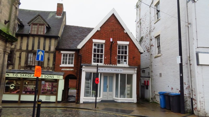
Entry Name: 31, Market Place
Listing Date: 24 October 1950
Grade: II
Source: Historic England
Source ID: 1293507
English Heritage Legacy ID: 272934
ID on this website: 101293507
Location: Uttoxeter, East Staffordshire, ST14
County: Staffordshire
District: East Staffordshire
Civil Parish: Uttoxeter
Built-Up Area: Uttoxeter
Traditional County: Staffordshire
Lieutenancy Area (Ceremonial County): Staffordshire
Church of England Parish: Uttoxeter St Mary Virgin
Church of England Diocese: Lichfield
Tagged with: Building
1.
1756
SK 0933
1/46
24.10.50
MARKET PLACE
No 31
II
2.
A gable-ended building with C19 brick front of 2 storeys with 2 windows over
shop front. Side elevation (up passage on right-hand side) shows early timber
framing of some merit.
Listing NGR: SK0921333372
External links are from the relevant listing authority and, where applicable, Wikidata. Wikidata IDs may be related buildings as well as this specific building. If you want to add or update a link, you will need to do so by editing the Wikidata entry.


Other nearby listed buildings
