Approximate Location Map
Large Map »
Latitude: 52.8978 / 52°53'52"N
Longitude: -1.8645 / 1°51'52"W
OS Eastings: 409210
OS Northings: 333379
OS Grid: SK092333
Mapcode National: GBR 38R.9FW
Mapcode Global: WHCFP.BFCB
Plus Code: 9C4WV4XP+45
Entry Name: 33 and 35, Market Place
Listing Date: 26 March 1973
Grade: II
Source: Historic England
Source ID: 1374331
English Heritage Legacy ID: 272935
ID on this website: 101374331
Location: Uttoxeter, East Staffordshire, ST14
County: Staffordshire
District: East Staffordshire
Civil Parish: Uttoxeter
Built-Up Area: Uttoxeter
Traditional County: Staffordshire
Lieutenancy Area (Ceremonial County): Staffordshire
Church of England Parish: Uttoxeter St Mary Virgin
Church of England Diocese: Lichfield
Tagged with: Building
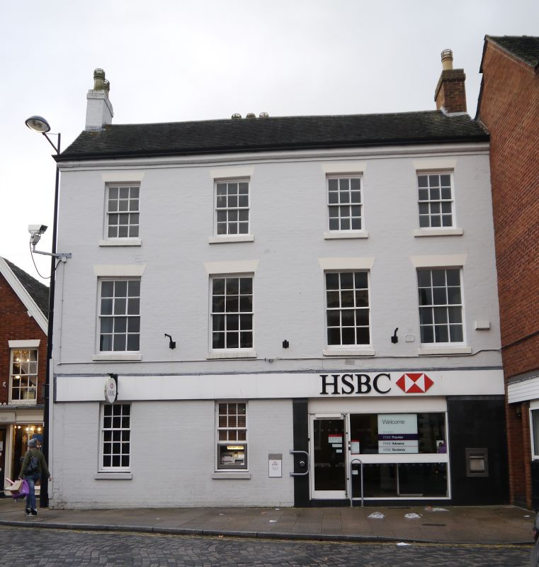
MARKET PLACE
1.
1756
Nos 33 and 35
SK 0933 1/94
II
2.
Late C18 or early C19. Painted brick; 3 storeys; 4 sash windows; corbelled
eaves; tiles. Modern shop and bank front.
Listing NGR: SK0921033379
External links are from the relevant listing authority and, where applicable, Wikidata. Wikidata IDs may be related buildings as well as this specific building. If you want to add or update a link, you will need to do so by editing the Wikidata entry.


Other nearby listed buildings
