Approximate Location Map
Large Map »
Latitude: 52.7687 / 52°46'7"N
Longitude: -1.7907 / 1°47'26"W
OS Eastings: 414219
OS Northings: 319032
OS Grid: SK142190
Mapcode National: GBR 4CQ.J2B
Mapcode Global: WHCG9.GNJT
Plus Code: 9C4WQ695+FP
Entry Name: Forge Cottage
Listing Date: 26 April 1984
Grade: II
Source: Historic England
Source ID: 1038505
English Heritage Legacy ID: 273540
ID on this website: 101038505
Location: Yoxall, East Staffordshire, DE13
County: Staffordshire
District: East Staffordshire
Civil Parish: Yoxall
Built-Up Area: Yoxall
Traditional County: Staffordshire
Lieutenancy Area (Ceremonial County): Staffordshire
Church of England Parish: Yoxall St Peter
Church of England Diocese: Lichfield
Tagged with: Cottage
SK 1418
7/15
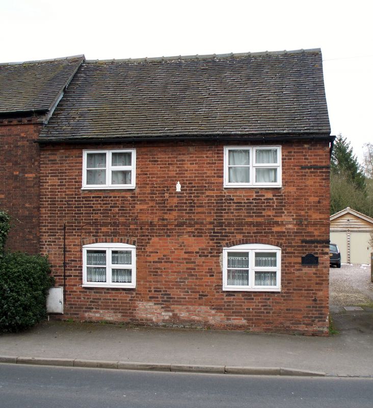
YOXALL
MAIN STREET (east side)
Forge Cottage
GV
II
Probably of late C18 origin but much altered. Red brick with toothed eaves and tiled roof. Two storeys. Two renewed casement windows, the lowers with segmental heads. Later plain doorway on south side.
Listing NGR: SK1421919032
External links are from the relevant listing authority and, where applicable, Wikidata. Wikidata IDs may be related buildings as well as this specific building. If you want to add or update a link, you will need to do so by editing the Wikidata entry.


Other nearby listed buildings
