Approximate Location Map
Large Map »
Latitude: 53.1817 / 53°10'54"N
Longitude: -1.869 / 1°52'8"W
OS Eastings: 408849
OS Northings: 364960
OS Grid: SK088649
Mapcode National: GBR 358.G9L
Mapcode Global: WHCDB.8976
Plus Code: 9C5W54JJ+M9
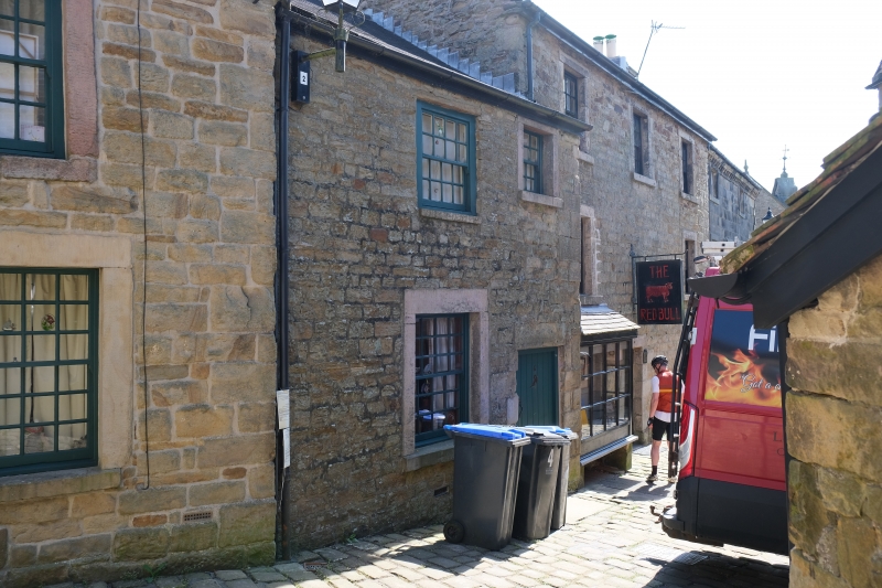
Entry Name: 6, Chapel Street
Listing Date: 5 June 1985
Grade: II
Source: Historic England
Source ID: 1038200
English Heritage Legacy ID: 274268
ID on this website: 101038200
Location: Longnor, Staffordshire Moorlands, Staffordshire, SK17
County: Staffordshire
District: Staffordshire Moorlands
Civil Parish: Longnor
Traditional County: Staffordshire
Lieutenancy Area (Ceremonial County): Staffordshire
Church of England Parish: Longnor St Bartholomew
Church of England Diocese: Lichfield
Tagged with: Building
SK 06 NE
5/54
LONGNOR C.P.
CHAPEL STREET
No 6
GV
II
Cottage. Early C19. Rough-faced coursed stonework; blue machine tile
roof. Two-storey, two-window front; glazing bar sashes. Main range
set centrally with block dressings to ground floor; entrance to right,
ledged door, with a further window above under the eaves. Included
for group value.
Listing NGR: SK0884964960
External links are from the relevant listing authority and, where applicable, Wikidata. Wikidata IDs may be related buildings as well as this specific building. If you want to add or update a link, you will need to do so by editing the Wikidata entry.


Other nearby listed buildings
