Approximate Location Map
Large Map »
Latitude: 53.161 / 53°9'39"N
Longitude: -1.8547 / 1°51'16"W
OS Eastings: 409812
OS Northings: 362665
OS Grid: SK098626
Mapcode National: GBR 35G.ZWD
Mapcode Global: WHCDB.HT12
Plus Code: 9C5W546W+C4
Entry Name: Ridge End Farmhouse
Listing Date: 5 June 1985
Grade: II
Source: Historic England
Source ID: 1038218
English Heritage Legacy ID: 274312
ID on this website: 101038218
Location: Staffordshire Moorlands, Staffordshire, SK17
County: Staffordshire
District: Staffordshire Moorlands
Civil Parish: Sheen
Traditional County: Staffordshire
Lieutenancy Area (Ceremonial County): Staffordshire
Church of England Parish: Sheen St Luke
Church of England Diocese: Lichfield
Tagged with: Farmhouse
SK 06 SE
5/96
SHEEN C . P .
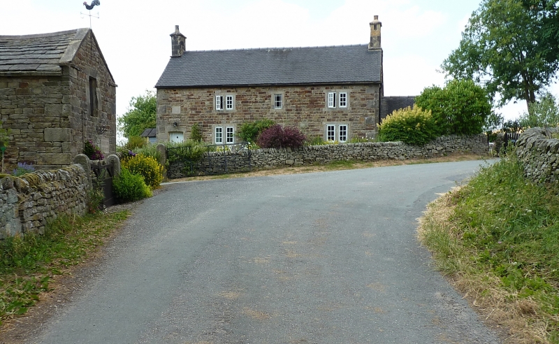
Ridge End Farmhouse
II
Farmhouse. Dated 1744. Coursed rough-faced stone and block dressings;
blue machine tile roof; stone end stacks. Two-storey, three-window
front of 2-1-2 light flat mullion casements; boarded door set to left
hand end with elliptically arched head and datestone over inscribed
E
W G
1744
Listing NGR: SK0981262665
External links are from the relevant listing authority and, where applicable, Wikidata. Wikidata IDs may be related buildings as well as this specific building. If you want to add or update a link, you will need to do so by editing the Wikidata entry.


Other nearby listed buildings
