Approximate Location Map
Large Map »
Latitude: 53.1298 / 53°7'47"N
Longitude: -1.9921 / 1°59'31"W
OS Eastings: 400622
OS Northings: 359186
OS Grid: SK006591
Mapcode National: GBR 24C.TBC
Mapcode Global: WHBCB.CLLG
Plus Code: 9C5W42H5+W4
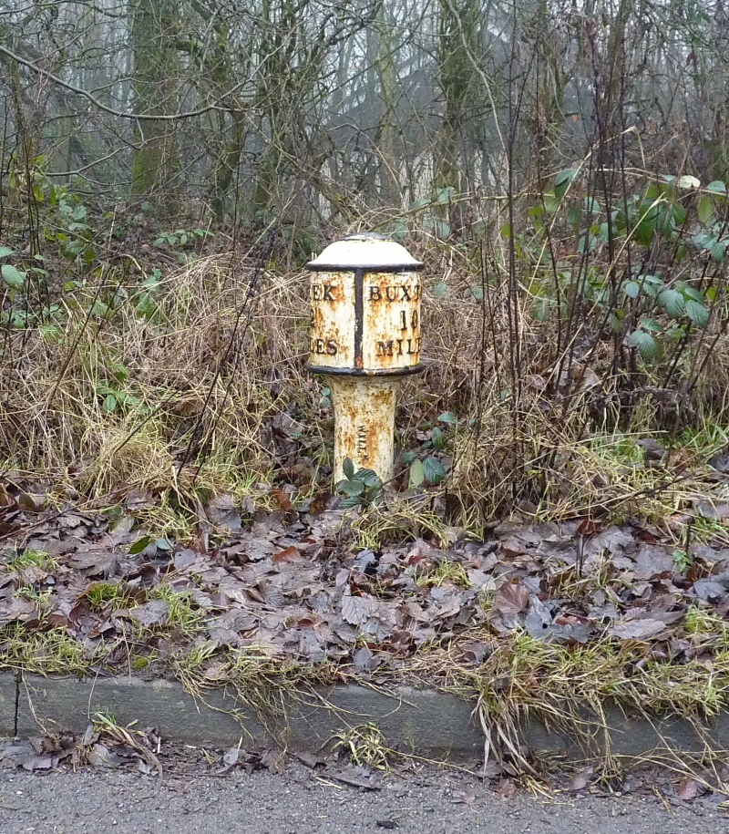
Entry Name: Milepost Leek 2 Miles
Listing Date: 5 June 1985
Grade: II
Source: Historic England
Source ID: 1038190
English Heritage Legacy ID: 274340
ID on this website: 101038190
Location: Blackshaw Moor, Staffordshire Moorlands, Staffordshire, ST13
County: Staffordshire
District: Staffordshire Moorlands
Civil Parish: Tittesworth
Traditional County: Staffordshire
Lieutenancy Area (Ceremonial County): Staffordshire
Church of England Parish: Leek St Edward the Confessor
Church of England Diocese: Lichfield
Tagged with: Milestone
SK 05 NW TITTESWORTH C.P. A53
SK 007592
8/123 Milepost Leek
- 2 miles
- II
Milepost. Late C19. Painted cast iron. Approximately 700mm high,
circular shaft and enlarged head with raised lettering on head:
"LEEK 2 MILES/BUXTON 10 MILES".
Listing NGR: SK0062259186
External links are from the relevant listing authority and, where applicable, Wikidata. Wikidata IDs may be related buildings as well as this specific building. If you want to add or update a link, you will need to do so by editing the Wikidata entry.


Other nearby listed buildings
