Approximate Location Map
Large Map »
Latitude: 52.0334 / 52°2'0"N
Longitude: 0.7163 / 0°42'58"E
OS Eastings: 586423
OS Northings: 240707
OS Grid: TL864407
Mapcode National: GBR QHJ.FY1
Mapcode Global: VHKF9.C5K0
Plus Code: 9F422PM8+9G
Entry Name: 50, Ballingdon Street
Listing Date: 26 October 1971
Grade: II
Source: Historic England
Source ID: 1194713
English Heritage Legacy ID: 275929
ID on this website: 101194713
Location: Ballingdon, Babergh, Suffolk, CO10
County: Suffolk
District: Babergh
Civil Parish: Sudbury
Built-Up Area: Sudbury
Traditional County: Essex
Lieutenancy Area (Ceremonial County): Suffolk
Church of England Parish: Sudbury All Saints
Church of England Diocese: St.Edmundsbury and Ipswich
Tagged with: Building
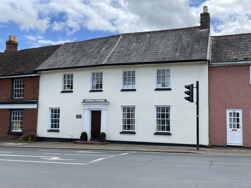
1. BALLINGTON STREET
1692 (South-East Side)
No 50
TL 8640 4/27
II
2.
Late Cl8 plastered brick front. 2 storey, roofs slate. 4 window range,
sash with glazing bars. blood doorcase with flat hood, reeded pilasters
and altered door.
Listing NGR: TL8642340707
External links are from the relevant listing authority and, where applicable, Wikidata. Wikidata IDs may be related buildings as well as this specific building. If you want to add or update a link, you will need to do so by editing the Wikidata entry.


Other nearby listed buildings
