Approximate Location Map
Large Map »
Latitude: 52.0334 / 52°2'0"N
Longitude: 0.7157 / 0°42'56"E
OS Eastings: 586377
OS Northings: 240698
OS Grid: TL863406
Mapcode National: GBR QHJ.FRL
Mapcode Global: VHKF9.C561
Plus Code: 9F422PM8+87
Entry Name: The Transport Cafe
Listing Date: 26 October 1971
Grade: II
Source: Historic England
Source ID: 1037521
English Heritage Legacy ID: 275954
ID on this website: 101037521
Location: Ballingdon, Babergh, Suffolk, CO10
County: Suffolk
District: Babergh
Civil Parish: Sudbury
Built-Up Area: Sudbury
Traditional County: Essex
Lieutenancy Area (Ceremonial County): Suffolk
Church of England Parish: Sudbury All Saints
Church of England Diocese: St.Edmundsbury and Ipswich
Tagged with: Building
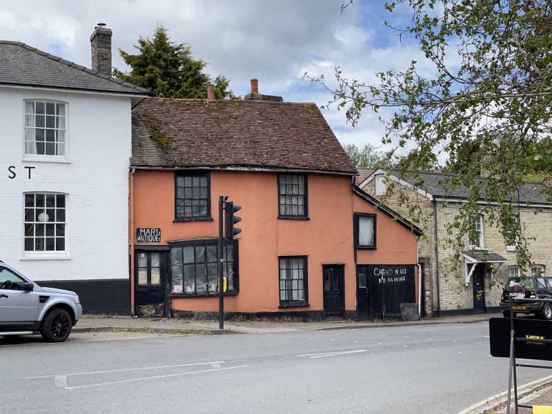
1. BULMER ROAD
1692 The Transport Cafe
TL 8640 4/189
II G17
2.
Probably C17 in origin, altered C18 and later, 2 storeys, windows double
hung with glazing bars, ground floor shop bow window. Old tile roof.
The King's Head Public House and The Transport Cafe form a group with the
listed buildings in the North-West Side of Ballingdon Street.
Listing NGR: TL8637740698
External links are from the relevant listing authority and, where applicable, Wikidata. Wikidata IDs may be related buildings as well as this specific building. If you want to add or update a link, you will need to do so by editing the Wikidata entry.


Other nearby listed buildings
