Approximate Location Map
Large Map »
Latitude: 52.0406 / 52°2'26"N
Longitude: 0.7249 / 0°43'29"E
OS Eastings: 586979
OS Northings: 241532
OS Grid: TL869415
Mapcode National: GBR QHJ.42B
Mapcode Global: VHKF3.JZ20
Plus Code: 9F422PRF+7X
Entry Name: 19, the Croft
Listing Date: 26 October 1971
Grade: II
Source: Historic England
Source ID: 1351345
English Heritage Legacy ID: 275970
ID on this website: 101351345
Location: Sudbury, Babergh, Suffolk, CO10
County: Suffolk
District: Babergh
Civil Parish: Sudbury
Built-Up Area: Sudbury
Traditional County: Suffolk
Lieutenancy Area (Ceremonial County): Suffolk
Church of England Parish: Sudbury St Gregory with Chilton St Peter
Church of England Diocese: St.Edmundsbury and Ipswich
Tagged with: Building
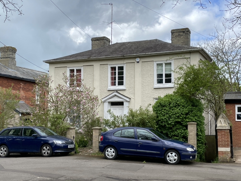
1. THE CROFT
l692
(West-Side)
No 19
TL 8641 3/151
II GV
2.
Early C19 roughcast with plain pilasters, and band to small eaves soffit.
Slates. Near flush frame windows, casements lst floor, sash with glazing
bars ground floor. Central entrance with wood case with quasi pediment.
All the listed buildings in The Croft (West Side) form a group.
Listing NGR: TL8697941532
External links are from the relevant listing authority and, where applicable, Wikidata. Wikidata IDs may be related buildings as well as this specific building. If you want to add or update a link, you will need to do so by editing the Wikidata entry.


Other nearby listed buildings
