Approximate Location Map
Large Map »
Latitude: 52.0414 / 52°2'29"N
Longitude: 0.7254 / 0°43'31"E
OS Eastings: 587014
OS Northings: 241622
OS Grid: TL870416
Mapcode National: GBR QHB.XYJ
Mapcode Global: VHKF3.JYCD
Plus Code: 9F422PRG+H5
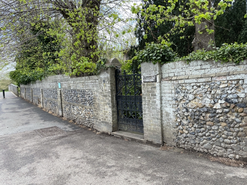
Entry Name: Front Wall of Garden of the Convent
Listing Date: 26 October 1971
Grade: II
Source: Historic England
Source ID: 1351346
English Heritage Legacy ID: 275975
ID on this website: 101351346
Location: Sudbury, Babergh, Suffolk, CO10
County: Suffolk
District: Babergh
Civil Parish: Sudbury
Built-Up Area: Sudbury
Traditional County: Suffolk
Lieutenancy Area (Ceremonial County): Suffolk
Church of England Parish: Sudbury St Gregory with Chilton St Peter
Church of England Diocese: St.Edmundsbury and Ipswich
Tagged with: Wall
1. THE CROFT
1692
(North West Side)
Front wall of garden
of The Convent
TL 8741 2/155A
II
2.
The greater length of the front garden wall is of flint and brick. History
of Sudbury, Grimwood and Kay, page 61.
Listing NGR: TL8701441622
External links are from the relevant listing authority and, where applicable, Wikidata. Wikidata IDs may be related buildings as well as this specific building. If you want to add or update a link, you will need to do so by editing the Wikidata entry.


Other nearby listed buildings
