Approximate Location Map
Large Map »
Latitude: 52.0361 / 52°2'10"N
Longitude: 0.7265 / 0°43'35"E
OS Eastings: 587106
OS Northings: 241035
OS Grid: TL871410
Mapcode National: GBR QHJ.BGX
Mapcode Global: VHKF9.J2XX
Plus Code: 9F422PPG+FH
Entry Name: Wall North West of Sports Ground
Listing Date: 26 October 1971
Grade: II
Source: Historic England
Source ID: 1037501
English Heritage Legacy ID: 276004
ID on this website: 101037501
Location: Sudbury, Babergh, Suffolk, CO10
County: Suffolk
District: Babergh
Civil Parish: Sudbury
Built-Up Area: Sudbury
Traditional County: Suffolk
Lieutenancy Area (Ceremonial County): Suffolk
Church of England Parish: Sudbury St Gregory with Chilton St Peter
Church of England Diocese: St.Edmundsbury and Ipswich
Tagged with: Wall
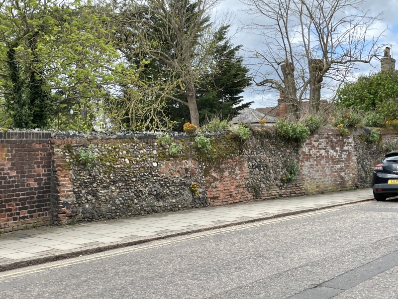
1. FRIARS STREET
1692
(South East Side)
Wall North West of
Sports Ground
TL 8741 3/164
II
2.
Possibly C18, red brick mainly.
Listing NGR: TL8710641035
External links are from the relevant listing authority and, where applicable, Wikidata. Wikidata IDs may be related buildings as well as this specific building. If you want to add or update a link, you will need to do so by editing the Wikidata entry.


Other nearby listed buildings
