Approximate Location Map
Large Map »
Latitude: 52.0367 / 52°2'12"N
Longitude: 0.7245 / 0°43'28"E
OS Eastings: 586968
OS Northings: 241092
OS Grid: TL869410
Mapcode National: GBR QHJ.9Z2
Mapcode Global: VHKF9.H2VH
Plus Code: 9F422PPF+MQ
Entry Name: 86-88, Friars Street
Listing Date: 26 October 1971
Last Amended: 28 January 1999
Grade: II
Source: Historic England
Source ID: 1351377
English Heritage Legacy ID: 276030
ID on this website: 101351377
Location: Sudbury, Babergh, Suffolk, CO10
County: Suffolk
District: Babergh
Civil Parish: Sudbury
Built-Up Area: Sudbury
Traditional County: Suffolk
Lieutenancy Area (Ceremonial County): Suffolk
Church of England Parish: Sudbury All Saints
Church of England Diocese: St.Edmundsbury and Ipswich
Tagged with: Building
SUDBURY
TL8641
FRIARS STREET
(north west side)
591/3/71
Nos 86-88 (even)
26.10.71
GV II
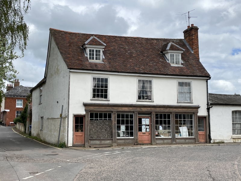
Probably C18, 2 storey and attics (2 hipped dormers), roofs tiled. Timber framed, plastered and painted. Front has 3 window range, large double hung sashes with glazing bars. Late C18 shop front. Included for group value.
Listing NGR: TL8696841092
External links are from the relevant listing authority and, where applicable, Wikidata. Wikidata IDs may be related buildings as well as this specific building. If you want to add or update a link, you will need to do so by editing the Wikidata entry.


Other nearby listed buildings
